Tag Archives: Dunqulah Agouza

Kushitic Oromos’ Ancestry in Ethiopia (: Ancient Sudan) & Semitic Amharas’ & Tigrays’ (Abyssinians’) Ancestry in Yemen

The following text is a response sent to an email dispatched to me by the Chairman of the exiled Oromo Parliamentarians who struggle for the Independence and Self-determination of the 5 millennia long Kushitic Ethiopian Nation of the Oromos.

The Hamitic – Kushitic Oromo Nation – due to criminal, inhuman and evil persecution conceived by the colonial powers (France, England and America) and executed by the colonially promoted barbaric and incestuous pseudo-Christian Abyssinians – lost their kingdoms and were engulfed within the Cemetery of Nations Fake Ethiopia, which consists in the world’s most tyrannical realm and the location of the world’s more abhorrent, more enduring, and more multifaceted genocides. There are more than 45 million Oromos in Abyssinia (Fake Ethiopia) and Kenya today, despite the notorious and pathetic falsehood propagated by Wikipedia. 

The present text enumerates all the major points of historical distortion and falsification carried out and diffused by the colonial academia, mass media, and diplomats, as well as by their local agents and criminal executioners, i.e. the barbaric, incestuous and Anti-Christian tribes of Amhara and Tigray (: the Abyssinians), who usurped the fair name of Ethiopia, which historically denotes the land of North Sudan and the Kushitic Nation that prospered there either in the Antiquity or in the Christian Era. Both, the Oromos and the Arabic-speaking (but not Arab) populations of Northern-Central Sudan are the descendants of Ancient Sudan’s (i.e. Ancient Ethiopia’s) Kushitic populations.

Representative photographic documentation was herewith added to the text in order to better illustrate the topic.

Refutation of historical forgeries propagated by European colonials and incestuous Abyssinians

Dear Chairman,

Thank you for your email and news!

I never watch or hear anything produced by the BBC because I know quite well that they have systematically distorted History either they present programs about Asia or they feature Africa, Europe or America.

Thanks to your email, I noticed that this video is not the actual documentary but an announcement for mere publicity.

But it is true that Axum was an Abyssinian capital, and it had nothing to do with Kush/Ethiopia, which was located at the time in the area of today’s North Sudan.


Ancient Sudan, as the true Ethiopia (or Kush), and its great past

Kush/Ethiopia was a millennia-long civilization; its three main periods of rise cover the three main stages:

1) Kerma Civilization (2300-1500 BCE),

1 Kerma.jpg

2 Kerma Deffufa.JPG

3 Kerma.jpg

(Kerma Deffufa, North Sudan)

2) Napata/Karima Civilization (which is mainly called Kushitic Civilization: 800 – 400 BCE) and

6 Napata.jpg

5 Napata.jpg

4 Napata.jpg

Napata (Karima & Jebel Barkal, North Sudan)

3) Meroe/Bagrawiyah Civilization (which is mainly called Meroitic Civilization and corresponds to what Ancient Greeks & Romans called ‘Ethiopia’: 400 BCE – 350 CE).

7 Meroe.jpg
Meroe, Capital of Ethiopia (Kush: North Sudan)

10 Mussawarat.jpg

9 Mussawarat.JPG

Mussawarat as Sufrah, a major city of the Meroitic Kingdom of Ethiopia in North Sudan

8 Wad ben Naga.jpg

Wad ben Naga, a major city of the Meroitic Kingdom of Ethiopia in North Sudan

12 Naqa.jpg

11 Naqa.jpg

Naqa, a major city of the Meroitic Kingdom of Ethiopia in North Sudan

Kush/Ethiopia has ethnic, linguistic and cultural affinities with Kemet/Egypt, because both nations are Hamitic, like the Berbers (who are all the people living from Libya to Morocco), the Tuareg, the Haussa, and others. In fact, ancient Egyptian and Sudanese (:Ethiopian) civilizations were deeply intertwined and for the Ancient Egyptians the holiest place in the world was Napata (today’s Karima in North Sudan) as the original location of god Amon of Thebes (Luxor)!

((Beware! All Wikipedia articles contain truth and lies mixed in a sophisticated manner as per the French-English-American needs. Plus: there was never such thing as a “Nubian Civilization”; there were Nubians in both Kemet/Egypt and Kush/Ethiopia, but they never developed an independent civilization, nor did they form a separate state. Only in Christian times, there was a separate state called Nobatia, which existed for several centuries. When people speak of “Nubian pyramids” in today’s Sudan, either they are ignorant and uneducated or they forge History deliberately usurping the History that belongs to present day Sudanese and Oromos and which is Kushitic/Ethiopian of nature, and not Nubian))

Axumite Abyssinia: a late, tiny state of Yemenite settlers in Africa

13 Axum.jpg

Axum, Capital of the Kingdom of Abyssinia (covering Pre-Christian and Christian times)

13 Ancient Blocks With Sabaean Inscriptions Yeha.jpg

Ancient blocks with Yemenite Sabaean inscriptions from Yeha

Totally unrelated to the above was the formation of a small state around Yeha and Axum (Abyssinia) from Semtic, Yemenite settlers, who crossed the Red Sea in later ages. Yeha must have been built around the 3rd-2nd c. BCE and Axum around the 2nd-1st c. BCE, so they belong to the third (3) stage of Ancient Kushitic Civilization as per above. Earlier dates given for these settlements are academic dishonesty due to extensive bribery of scholars, which is – as you already know – a regular practice among the various dictatorial governments, Amhara- or Tigray-led, of Addis Ababa. Example: this article contains numerous deliberate errors and falsehood – https://en.wikipedia.org/wiki/D%CA%BFmt

In fact, Axum was a Yemenite kingdom on African soil; they were not Africans and for their entire pre-Islamic History, they were more concerned with Yemen than with Africa. However, despite all the lies that the Abyssinian governments and agents diffuse, the ancient Axumites had nothing in common with the Queen of Sheba (who lived around the 10th c. BCE in Yemen, when no Yemenite was on African soil). Sheba (Sabaa / Sabaeans) was actually the name of one of the most important Yemenite states; other important states were Qataban, Himyar, Awsan and Hadhramaut.

14 Marib.jpg
Marib, Capital of the Yemenite Kingdom of Sheba / Sabaa (Sabaeans)

16 Awam.jpg

Awam Temple – Yemenite Kingdom of Sheba / Sabaa (Sabaeans)

15.jpg

Zafar, Capital of the Yemenite Kingdom of Himyar (Himyarites)

17 Qataban.jpg

Antiquities from Timna, Capital of the Yemenite Kingdom of Qataban

18 Shabwah.JPG

Shabwah, Capital of the Yemenite Kingdom of Hadhramaut

18 hadhramaut.jpg

Antiquities from Shabwah, Capital of the Yemenite Kingdom of Hadhramaut

The Abyssinians (Habasha), who crossed the Red Sea and settled in Africa, were already mentioned in the Ancient Yemenite (Sabaean) texts as a renegade tribe (Abasat), and we have every reason to understand that they were expelled from their country of origin due to their heresy and evilness.

Meroe (Ethiopia) – Axum (Abyssinia) – Yemenite Sheba & Himyar – Berberia (Sudan’s coast) – The Other Berberia & Azania (Somalia’s coast)

The Axumite Abyssinians formed indeed a small state (limited between Axum and Adulis/near Massawa) and they never reached ever up to the area of Avalites (Assab) near the Red Sea straits. On the contrary, the two Yemenite states Sheba & Himyar merged and they controlled the entire Somali coast from the Horn of Africa down to today’s Daresalaam. This vast coast was a Yemenite colony for several centuries (perhaps up to a millennium at the times of early Islam), and it was named Azania (according to the Ancient Greek text Periplus of the Red Sea, which is also known as Periplus of the Erythraean Sea and was written in the middle of the 1st c. CE: around the years 70-75 CE).

19 Adulis Axum.jpg
Adulis (near Massawa, the only harbor of Axumite Abyssinia), Foundations of Christian Church

The same text gives details about Meroe, which was a big continental state with links across Sahara and with Roman Egypt, but did not control today’s Sudanese coast where – according to the same text – lived the ‘Berbers’ (Kushites who were rather independent from Meroe); for this reason that coast was called Berberia.

Same origin population lived in the coast from Avalites (Assab) to the Horn itself (so the area that today corresponds to Eritrea’s southernmost part, Djibouti, Somaliland, and a small part of Puntland); that’s why in the Periplus of the Erythraean Sea, the area from Assab to the Horn is named as “The Other Berberia” – something that also highlights the Kushite presence in that area. Beyond the Horn, the populations were Kushitic as well: the ancestors of today’s Somalis. Simply, the term ‘Azania’ (used within the Periplus of the Erythraean Sea) seems to have rather been a ‘political’ term to designate the Yemenite (Sheba/Himyar) colony across the East African coast.

Christian Ethiopian states on Sudan’s territory & Axumite Abyssinia

Axum accepted Christianity in the early 4th c. CE. According to vicious Amhara/Tigray propaganda, Axum was ‘the first Christian state in the world’; this is a lie. The first Christian state in the world was Osroene (an Aramaean state located on part of the territory of today’s Northern Syria and Southeastern Turkey): King Abgar the 9th of Osroene (179 – 214 CE) accepted Christianity as the official religion of his country – more than 150 years before King Ezana of Axum accepted Christianity after the Aramaean Syrian Frumentius (slave, missionary, bishop) preached Christianity there. The state of Osroene was indisputably the first Christian state in the world, and in addition to the above, there are discussions about King Abgar the 8th of Osroene being eventually the King to have Christianized Osroene earlier and about King Abgar the 5th of Osroene being eventually the King to have exchanged letters with Jesus (https://en.wikipedia.org/wiki/Abgar_V).

After Ezana made Axumite Abyssinia a Christian country, in coordination with the Christian Roman authorities in Alexandria and Constantinople, he attacked Meroe/Ethiopia (around 360 CE) and destroyed its capital at today’s Bagrawiyah. He then retreated after annexing the occupied territory. He then claimed that he was king of Axum and king of Ethiopia, like every other king who after invading a new land was considered to be king of that land.

However, Meroe/Ethiopia was a vast state covering most of today’s Northern Sudan’s territory. Ezana attacked Meroe’s capital from the south (probably advancing alongside Atbarah river) but the territory of Ethiopia that was occupied by Abyssinia’s Ezana was less than 20% of Ethiopia’s total area.

The claim was ridiculous and it would be tantamount to Hitler claiming to be the ruler of Soviet Union in 1942, because he only invaded part of its western territory.

However, the Abyssinian annexation of 20% of Ethiopia’s (Kush’s) territory did not last for long, and as early as the beginning of the 5th c. CE (so around the period 400-450 CE) Christian Nobatia rose in the Kushitic / Sudanese / Ethiopian North. Slightly later, a second Christian state, Makuria was formed in the Kushitic / Sudanese / Ethiopian mainland of the old Meroitic kingdom. Not much later, Christian Alodia, the third Christian Kingdom of Kush / Ethiopia / Sudan, appeared in the area around today’s Khartoum.

20 map Christian Ethiopia.png

((There are many correct and many wrong points here:

https://en.wikipedia.org/wiki/Nobatia / https://en.wikipedia.org/wiki/Makuria / https://en.wikipedia.org/wiki/Alodia)) Mainly, take into consideration that it is wrong to depict as ‘Nubian’ any other Christian kingdom of Kush / Sudan / Ethiopia except Nobatia. The population of Makuria and Alodia was Kushitic/Ethiopian, i.e. the descendants of the non-Christian Meroitic kingdom’s population.

Archaeological evidence makes it clear that all Meroitic sites were vastly depopulated after Ezana’s invasion of the small southern portion of Meroe / Ethiopia. For the rest of the 4th c. and the 5th c. CE Kush’s (Ethiopia’s) mainland in today’s North Sudan was depopulated. I interpreted this phenomenon as the massive Exodus of the ancestors of Oromos, who wanted to avoid the forced Christianization of their land and therefore left that land to find safe shelter further in the South, until they finally reached – after several steps – the highlands of today’s Oromia:

https://www.academia.edu/24273923/The_Meroitic_Ethiopian_Origins_of_the_Modern_Oromo_Nation_-_By_Prof._Dr._Muhammad_Shamsaddin_Megalommatis

However, when the Amhara / Tigray Abyssinians use the name ‘Ethiopia’ for the country that they formed after their colonial expansion and the genocides that they perpetrated in the period 1850-1950, they forget that Ezana’s claim was politically empty (since he did not invade but only a small portion of Ethiopia) and historically void, because ‘Christian Ethiopia’ as historical term defines the three Christian Kingdoms of Nobatia, Makuria and Alodia, and not the small kingdom of Axum, which collapsed after the arrival of Islam during the 7th c., whereas Christian Makuria survived until ca. 1400 CE and Christian Alodia existed until 1510-1520. This means that there was Christian continuity in Sudan / Ethiopia / Kush, but not in Abyssinia.

20 Nobatia Farras fresco.jpg

Fresco from the Cathedral of Faras, Capital of the Christian Kingdom of Nobatia

20.jpg

Fresco from the Cathedral of Faras, Capital of the Christian Kingdom of Nobatia

20 QUEEN MARTHA NOBATIA.jpg

Fresco from the Cathedral of Faras, Capital of the Christian Kingdom of Nobatia

22 OLD DONGOLA.jpg

Old Dongola (Dunqulah), Capital of the Christian Ethiopian Kingdom of Makuria, North Sudan

21 NATIVITY.jpg

Old Dongola (Dunqulah), Capital of the Christian Ethiopian Kingdom of Makuria, North Sudan – Fresco of the Adoration of the Magi

21 Makuria.jpg

Christian Ethiopian Art & Inscription from the Ethiopian Kingdom of Makuria, North Sudan 

23 Alodia.png

Major expansion of Alodia, the third (and southernmost) Kingdom of Christian Ethiopia (: Sudan)

23 Soba_East,Granitsäulen.jpg

Soba (Khartoum), Capital of the Christian Ethiopian Kingdom of Alodia – foundations of one of the main churches

23.jpg

Tombstone of the Christian Ethiopian King David, Soba (Khartoum) – Capital of Alodia

Axum Abyssinia, Agaw Kushite Kingdom, and Yekuno Amlak’s Satanic state

Almost 300 years after the disappearance of Axum, around 950 CE, in the northern part of today’s Abyssinia, the tiny Christian Agaw state was formed with Lalibela as capital and it lasted until 1270; however this was also a Kushite kingdom because the Agaw Nation is of Kushitic ethnic background. A lot of posterior traditions due to evil colonial motives have obscured the historical reality around the Agaw kingdom, but you can be sure for the following:

24 Lalibela.jpg

Lalibela, Capital of the Christian Kushitic Kingdom of Agaw in the southern extremities of the Old Abyssinian Kingdom of Axum

a. The Agaw Kingdom had no royal or ethnic connection with / continuity from Axum; all opposite claims and mentions of intermarriage are fake. The Semitic descendants of the Axum kingdom were surely among the Agaw kingdom’s subjects, but they did not belong to the ruling royal elite; they were one of the nations that lived under the Agaw scepter and we have reason to believe that they hated it too much.

24 Agaw king.png

Agaw kingship is totally unrelated to the posterior barbaric state launched by Yekuno Amlak. Pictorial documentation demonstrates the Kushitic identity of the Christian Kingdom of Agaw. The blood of the brave last King of the Agaw Kingdom is a curse for the Amhara & Tigray Abyssinians, heralding their total extinction.

b. The Agaw state was a small Kushitic Christian kingdom that never claimed royal or ethnic descent from the Semitic, Yemenite kingdom of Axum and never claimed to be ‘Ethiopia’ – because at those days the Ethiopian kingdoms were Nobatia, Makuria (which merged soon afterwards into one state), and also Alodia.

c. There was indeed a religious continuity between Axum and Agaw kingdoms.

d. There was never an Axumite Abyssinian text to support an eventual claim of royal Axumite descent from the Queen of Sheba & Solomon. Not one Axumite Abyssinian king ever made such a claim.

e. The Semitic Abyssinian Amhara state that was launched by Yekuno Amlak in 1270 has no royal connection with either the Axum or the Agaw kingdoms.

f. The Semitic Abyssinian Amhara state has indeed an ethnic connection with the Semitic descendants of the Axum kingdom; one part of them represents a rather direct descent from the Axumite population (Tigray), whereas the other part is characterized with a certain amalgamation with other populations (Amhara).

This state consisted in a racist entity and an oppressive mechanism against all the non-Amhara and non-Tigray subjects of its territory.

g. In striking contradiction with the Axum and the Agaw kingdoms, the barbaric state launched by Yekuno Amlak at 1270 was never a real kingdom (and much less, an empire, as the Amhara and Tigray Abyssinians have fallaciously pretended), because

i) there was not a dynastic continuity to properly ensure a real royal descent (if the so-called ‘king’ is not the son, grandson, brother, uncle, cousin or nephew of a king, if he does not even belong to the noble class, i.e. the peerage, but has a common or low descent, he can never be a king) and

ii) – more importantly – there is no notion of ‘family’ in the incestuous Amhara society, which means that there cannot be proper ‘royal’ family to offer heads of states possibly able be called ‘kings’ or ’emperors’. The sons of different lowly prostitutes who were ‘married’ to several men can never become ‘kings’ by any standards anytime anywhere in the world. That’s why the Oromo, the Hadiya, the Somali, the Kaffa and other real African kings never accepted those trashy, vulgar, incestuous Amhara or Tigray barbarians as ‘kings’ and never conceded to several demands for a ‘royal’ meeting (: a king never encounters a filthy trash like the Amhara – Tigray bogus-kings).

h. What is more unknown to most people worldwide is that there is not even religious continuity between the Axum and the Agaw kingdoms on one side and the state of Yekuno Amlak on the other side. Post-1270 ‘Christianity’ among the Amhara – Tigray incestuous tribes has nothing in common with either the Lalibela-centered Agaw Christianity or the Axum-based Old Abyssinian Christianity.

The reason is simple; with the proclamation of Yekuno Amlak’s villainous and atrocious state, a new text of fake royal propaganda appeared, ‘Kebra Negast’, which was accepted by the Abyssinians down to Haile Selassie as the epitome of the state’s nature, claims and aspirations. The book accepts Christianity in an heretic manner whereas it distorts all the basic principles of Christian morality. Furthermore, Kebra Negast propagates a great number of Anti-Christian concepts, Satanic theories, counterfeit ideas, historical fallacies, dynastic forgeries, and factual distortions that make it totally impossible for anyone accepting this text to properly be a Christian.

This is the reason the Amhara and the Tigray Abyssinian rulers never accepted Christian Catholic missionaries in their marginal, arid, tiny and ill-fated bogus-kingdom, and they always slaughtered them mercilessly. During the period 1300-1850, more Catholic priests were killed in the then tiny territory of Abyssinia than in any other part of the world, the Islamic Caliphate and other Islamic Empires included.

Two different Abyssinian claims to the Name of Ethiopia: Ezana’s and Haile Selassie’s

Finally, one must clearly make a distinction between Ezana’s claim to the title of ‘king of Ethiopia’ and the recent Abyssinian policies (that date back only to 1950s) and false pretensions that Abyssinia can be possibly called ‘Ethiopia’, which consist in sheer usurpation of a name that is totally unrelated to the Amhara and Tigray Abyssinians and their past.

25 EzanaGreekTablet.jpg
King Ezana’s inscription – the Greek text

King Ezana’s claim was something normal as practice at those days. Example: Publius Cornelius Scipio was a Roman general and later consul who is often regarded as one of the greatest generals and military strategists of all time. His main achievements were during the Second Punic War (218 – 201 BCE) where he is best known for defeating Hannibal at the final battle at Zama, one of the feats that earned him the agnomen Africanus. Because he won over the African state of Carthage, he was called Scipio the ‘African’.

However, when the Abyssinian control of the small part of Ethiopian (Sudanese) territory ended few decades later and Nobatia, Makuria and Alodia rose to prominence as the three Christian states on the Ethiopian (e. g. North Sudanese) territory, any Axumite Abyssinian claim to the name of Ethiopia was purely void, fully insignificant, and practically meaningless.

As a matter of fact, the modern claim is rather relevant to Anti-Christian eschatological and messianic beliefs introduced among the Abyssinians only with the aforementioned forgery of Kebra Negast, a text that can be considered as Christian as the devious Jewish forgery of ‘Talmud’ can be described as Biblical Hebrew!

“Ethiopia shall hasten [to stretch out] her hand readily to God

The eschatological and messianic beliefs introduced among the Abyssinians are based on a Biblical text of the Old Testament (Psalms, 67:32) in which the Septuagint Greek text reads “ἥξουσι πρέσβεις ἐξ Αἰγύπτου, Αἰθιοπία προφθάσει χεῖρα αὐτῆς τῷ Θεῷ”, which is translated in Modern English “Ambassadors shall arrive out of Egypt; Ethiopia shall hasten [to stretch out] her hand readily to God”. (http://www.ellopos.net/elpenor/greek-texts/septuagint/chapter.asp?book=24&page=67)

{{Here I must add that you must never use the false English translation prepared by the evil, bastard and Freemason king of England James I (reign: 1603 – 1625), the so-called King James Version – KJV – because it is part of the same Satanic conspiracy that brought the Amhara and the Tigray Abyssinian invaders to your lands and provided for the 150-year long Oromo Genocide and many other genocides of subjugated African nations across Abyssinia and elsewhere. This extremely distorted translation (King James Version / KJV) serves only to diffuse confusion and falsehood and to promote the enslavement of all the nations of the world to Satan and all the filthy and evil spirits. King James I was an evil person and an accomplished Satanist, who took even the pain of writing a book titled “Daemonologie”, which is “a philosophical dissertation on contemporary necromancy and the historical relationships between the various methods of divination used from ancient Black magic. This included a study on demonology and the methods demons used to trouble men while touching on topics such as werewolves and vampires”. (https://en.wikipedia.org/wiki/Daemonologie) You understand, of course, that whoever diffuses the words of filthy spirits and evil demons cannot possibly be involved in the holy texts of any religion, except for the purpose of falsifying them as per the guidance given to him by the evil spirits which he serves. With reference to modern English translations of the Christian Bible, beware also of many other fake English translations that repeat the same mistakes of KJV which is not a correct and direct translation from the Ancient Greek text but from a late Jewish forgery, the so-called masoretic text of which the earlier manuscript dates back only to 9-10th c., namely more than 1000 years after the Greek text of the Hebrew Bible! More: http://www.newadvent.org/cathen/10035a.htm / But this is all mistaken: https://en.wikipedia.org/wiki/Masoretic_Text}}

Now, why was the verse “Ambassadors shall arrive out of Egypt; Ethiopia shall hasten [to stretch out] her hand readily to God” thought to be of eschatological and messianic meaning?

A Kushitic Ethiopian Prince from Meroe & Ancestor of the Oromos speaks with Philip, one of Jesus’ disciples

This is due to the fact that there is a reference in the New Testament (Acts, 8:26-40) according to which there was an ‘Ethiopian’ prince, who while traveling in Palestine met and spoke with Philip, one of Jesus’ disciples (https://en.wikipedia.org/wiki/Philip_the_Apostle), and then accepted Jesus’ preaching and became Christian.

Here you have the entire narration: “26 And the angel of the Lord spake unto Philip, saying, Arise, and go toward the south unto the way that goeth down from Jerusalem unto Gaza, which is desert. 27 And he arose and went: and, behold, a man of Ethiopia, an eunuch of great authority under Candace queen of the Ethiopians, who had the charge of all her treasure, and had come to Jerusalem for to worship, 28 Was returning, and sitting in his chariot read Esaias the prophet. 29 Then the Spirit said unto Philip, Go near, and join thyself to this chariot. 30 And Philip ran thither to him, and heard him read the prophet Esaias, and said, Understandest thou what thou readest? 31 And he said, How can I, except some man should guide me? And he desired Philip that he would come up and sit with him. 32 The place of the scripture which he read was this, He was led as a sheep to the slaughter; and like a lamb dumb before his shearer, so opened he not his mouth: 33 In his humiliation his judgment was taken away: and who shall declare his generation? for his life is taken from the earth. 34 And the eunuch answered Philip, and said, I pray thee, of whom speaketh the prophet this? of himself, or of some other man? 35 Then Philip opened his mouth, and began at the same scripture, and preached unto him Jesus. 36 And as they went on their way, they came unto a certain water: and the eunuch said, See, here is water; what doth hinder me to be baptized? 37 And Philip said, If thou believest with all thine heart, thou mayest. And he answered and said, I believe that Jesus Christ is the Son of God. 38 And he commanded the chariot to stand still: and they went down both into the water, both Philip and the eunuch; and he baptized him. 39 And when they were come up out of the water, the Spirit of the Lord caught away Philip, that the eunuch saw him no more: and he went on his way rejoicing. 40 But Philip was found at Azotus: and passing through he preached in all the cities, till he came to Caesarea”. (http://www.ellopos.net/elpenor/greek-texts/new-testament/acts/8.asp)

An ancestor of the Oromos accepted Jesus centuries before the ancestors of the Amhara and Tigray Abyssinians

26 Menologion_of_Basil.jpg

Miniature painting depicting Jesus’ disciple Philip and the Meroitic Ethiopian prince who accepted Jesus’ preaching and was baptized. From the Menologion of the Eastern Roman Emperor Basil II, which was compiled around the year 1000 – currently in the Vatican Library. (More: https://en.wikipedia.org/wiki/Menologion_of_Basil_II)


So, the historical forgers interpret the earlier verse (Psalms, 67:32) as being a prophecy that was materialized in the person of the Ethiopian prince. As you can understand, this concerns Kush / Sudan, i.e. the Kingdom of Ethiopia with Meroe as capital which was located in today’s North Sudan. Even more so because the New Testament excerpt includes a typically Meroitic / Ethiopian word, namely Kandake (Candace), which is not a personal name, but the title itself (lit. ‘queen’) in Meroitic / Ethiopian language. This article is correct: https://en.wikipedia.org/wiki/Kandake

We also know, thanks to Meroitic / Ethiopian textual documentation, that the title ‘King’ in Ancient Meroitic / Ethiopian was ‘Qore’ (https://en.wikipedia.org/wiki/List_of_monarchs_of_Kush). This Kushitic word has been preserved down to our times in Af Somali as ‘Boqor’ (https://en.wikipedia.org/wiki/Somali_aristocratic_and_court_titles).

Meroitic/Kushitic/Sudanese/Ethiopian Candace: Unrelated to Abyssinians

The use of the term ‘Candace’ makes the proof even stronger that the earlier Biblical text (Psalms) prophesied indeed the Christianization of Sudan / Kush / Ethiopia, first in the form of the traveling prince, and second, few centuries after the travel of the Ethiopian Meroitic prince in Palestine, when Nobatia, Makuria and Alodia became the three Christian states of Sudan/Ethiopia.

Abyssinia in any form (Axum or posterior) is totally unrelated to this story, and tiny Axum at the time was a non Christian country and remained as such for another 300 years! No Axumite Abyssinian prince traveled to Palestine at the times of the Apostles (Jesus’ disciples) and of course, there was no Candace/Kandake in Axum at those days or any time later!

The Abyssinian claim may look absurd. But this is always the nature of forgery! When evil people and barbaric nations like the Amhara / Tigray Abyssinians try to usurp the Past and the History of civilized nations, they raise false claims and come up with incredible misinterpretations that only criminals or paranoids dare express.

Last but not the least, the whole affair of the recent claim (which started with Haile Selassie in the 1950s) involves Westerners (colonial French academia), who then convinced the fake king Haile Selassie about using the name of Ethiopia instead of Abyssinia. This has a lot to do with Freemasonic and Zionist plans and conspiracies regarding Eastern Africa; however this is rather politics and not History.

A Sudanese-Oromo alliance to overthrow the genocidal Abyssinian tyranny

The best chance for the Oromos to counterbalance and overthrow the colonial conspiracy against their nation is to
1. reach out to today’s Arabic-speaking people and rulers of Sudan,
2. help them realize that
a. they are not Arabs, but linguistically Arabized Kushites of Sudan
b. they are straight descendants of the Ancient Sudanese / Kushites / Ethiopians
c. as such they are the truly fraternal nation to the Oromos
d. the real offspring of the Ancient Sudanese / Kushites / Ethiopians are both, the Oromos (who left their land but preserved and saved their language) and the Arabic-speaking Sudanese (who preserved their land but lost their own language)
e. the real name of their land (Sudan) and of Oromia is Ethiopia / Kush and that you and they must take it back from the Abyssinians
f. the Arabization project across Africa and Asia was conceived by the three colonial powers (France, England and America) that are controlled by Freemasonry and Zionism in order to destroy the nations to which it was projected and on which it was imposed (from Morocco to Iraq), and this is the reason for all the problems and disasters that fell on each of those nations, and
g. the only means of survival of today’s Sudan is the detachment from the fallacy of Pan-Arabism and the return to the true historical identity (Kushitic – Ethiopian) that their land had for millennia, and
3. establish an Oromo – Sudanese alliance to overthrow the tribal tyranny of the Abyssinians who consist in a minority within the colonial state of Fake Ethiopia.

Best regards,
Shamsaddin


Islam, Makuria, Sudan, Ethiopia and Abyssinia, Map Forgery & Historical Falsification at Berkeley

By Prof. Muhammad Shamsaddin Megalommatis

map_daralislam2

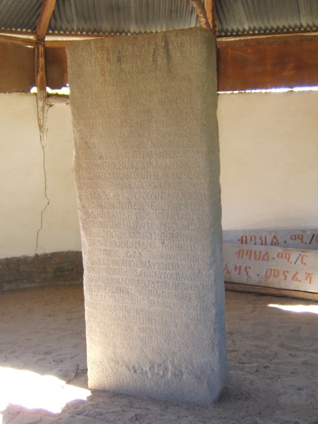
“Dar al-Islam (the Muslim World) in the 13th century” / From: “The Travels of Ibn Battuta. A Virtual Tour with the 14th Century Traveler” uploaded in the portal of Berkeley University (http://ibnbattuta.berkeley.edu/)


Sultanate of DelhiIndia

The Sultanate of Delhi during the 13th c., prior to the rise of Khilji dynasty (under the Mamluk dynasty), controlled a much smaller territory leaving not only the entire Gujarat but also large parts of Rajastan out of its control.

AlAndaluz1212AlAndaluz1265

13th c. Islamic territory in the Iberian Peninsula (above) & 14th c. Islamic Emirate of Granada in their real historical dimensions

Mamluks1279

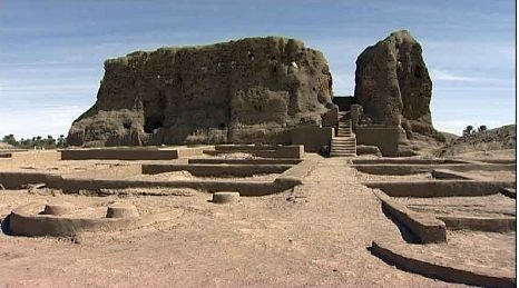
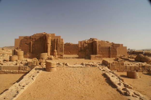
The correct borders of the Mamluk state of Egypt in the Red Sea

Involving many universities, publishing houses, mass media, encyclopedias (and notably the Wikipedia), diplomatic services, and international NGOs, a vast project of systematic map forgery of global dimensions can be attested in an almost infinite number of cases either on hard copies or online. The existing trends that can be assessed after a meticulous observation of many thousands of maps lead us to the conclusion that the undertaken forgery only reflects and strengthens the historical falsification that we can notice in the texts of articles, scholarly articles, encyclopedia entries, and books. In other words, the historical falsification that has been systematically carried out at global scale by the Freemasonic / Zionist academics and their assistants covers also an incredibly high number of maps that are available for general and specialized readership.


To analyze the character, the nature and the targets of the entire falsification process it would take volumes; however, one can briefly identify the targets as fully reflecting the essence of the historical, philosophical, religious, ideological and political falsehood that the Freemasonic / Zionist academics want to diffuse. In this case, we have to primarily deal with a vicious discrimination that takes first the unsuspicious form of a mere differentiation; some nations, peoples, countries, states, persons, concepts, and issues are favored, whereas others are disfavored.

As per the needs of the above differentiation, the historical truth is magnified, embellished, and better highlighted for those favored, whereas it is undermined, tarnished and concealed for those disfavored. The methods involved are numerous and much diversified. The size of an article is merely an example. When you publish a 3000 words entry in an encyclopedia to present the history of a less important nation, and you allot only 1500 words for the entry which is dedicated to the history of another, definitely more important nation, certainly your intentions are evil, your publications are biased, and your falsification targets are to elevate what you favor and to lower what you disfavor – particularly if the history of the more important nation happens in addition to be better documented with more historical sources, larger textual and epigraphic evidence, and a longer record of diverse archaeological findings.


Except the size of an entry, many other parameters matter as well, when it comes to a systematic falsification effort. The overall presentation, the presence or the absence of maps, pictures and diagrams, etc., everything in fact adds points to the said effort. The contents of the text, and of the maps, are certainly the most essential parts of the falsification effort, but undoubtedly not the only.


When it comes to the contents of the maps, a country can be shown bigger or smaller, the borderlines can be shifted to one or the other side, the details included can be many or few; furthermore, the background color (which defines the territoriality) can be extended beyond the level of historical reality or withdrawn to some lesser (and false) degree.


If the map contents concern a moment of the past, for the cartographic forgers the distortion needed to achieve the falsification target is certainly an easier job than in the case the map contents relate to a current situation. No one will accept in 2014 the veracity and the trustworthiness of a European political map that depicts Crimea with the same color as that of Ukraine, because it is known to all that Crimea does not belong anymore to Ukraine, having effectively seceded earlier this year.


But what happens in the case of a historical map dating back to the Islamic Ages, the Christian times or the periods of the Oriental Antiquity? In these cases, the map forgery process becomes easier. Similarly with common lies, map forgery combines elements of historical truth along with points of distortion; there cannot be a ‘full lie’, because no one will believe it. And there cannot be a total map forgery, because people will immediately identify the map as purely fictional, fake, and therefore worthless.


The extensive map forgery project reveals the existence of a detailed plan shared by many, and this takes us to the level of an advanced conspiracy. Those who deny the existence of conspiracies are contradicted and rejected by History itself, because in the last 5000 years of History we have come across thousands of cases of conspiracy undertaken by two or more people, countries or organizations against their specific targets.


Actually, if we accept for a moment the incredible falsehood that there has never been any conspiracy in the World History, we will have to interpret all the cases of map forgery and historical falsification as the result of mere human errors. This is not however possible, because there is plenty of evidence that many authors and researchers did not share the false view or idea (that takes the form of a specific map forgery or historical falsification) and that they presented a different viewpoint.


If, contrarily, these points that we consider as forgery were generally accepted as truthful and correct by all authors and researchers, and one specialist demonstrated that these points were actually wrong and mistaken, we could accept that, before the refutation and the rectification of the mistaken points, all scholars had committed an error.


We could even accept, in the case of some authors presenting the historical truth and others developing a different version, that the latter committed merely a mistake; but in this case, there should not be a specific trend (in favor of one land, country, state, nation, national history or person) that is repeated across many different maps, articles and books.


In this regard, a mere comparison helps us reveal the truth, i.e. identify whether a case of map forgery really took place. If the mistake is generally repeated by all, we can conclude that it is a real error. If the mistake occurs here and there, but there are more specialized publications that present a different, historically correct, view and do not accept the mistake, we have certainly to do with a case of deliberate forgery and not with a mistake; particularly if the specific target is the same as in many other cases of forgery, which means that the specific target was the common denominator in all these cases of forgery.


It is essential to point out at this moment that map forgery does not only occur in a specialized per subject map, but can be noticed in subject-unrelated maps and articles, which means that we are indeed in front of a vastly implemented project of forgery of disproportionate size.


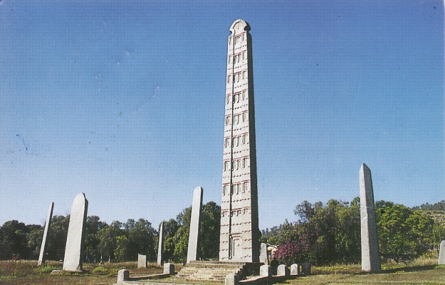
One of the modern countries that has been methodically supported by the vast map forgery project and the overall historical falsification program is Abyssinia (which only recently was also fallaciously re-baptized as ‘Ethiopia’ despite the fact that, as per the Ancient Greek and Roman sources whereby this name was first used, ‘Ethiopia’ is the state, the land and the Kushitic nation immediately south of Egypt, so today’s North Sudan).


As per the needs of the historical falsification, Ethiopia is presented confusingly and mistakenly as identical with Abyssinia (whereas it is not) and also as larger of dimension. Many different maps in diverse websites and books portray Abyssinia falsely and in size greater than its real as per the historical period concerned in order to boost its image.


Example of map forgery in the portal of Berkeley University, US


In the present article, I will focus only one map and demonstrate its forged nature. It is very shameful that the map was published in the portal of an American university, but given the biased position of the US government in so many issues, taken into account the existence of various lobbies and their corrupt practices, and bearing in mind the utilization of the US universities by the US establishment and the powers that be, one can understand why this forgery was attempted at the detriment of all readers.


The forgery example is therefore taken from a presentation which, under the title “The Travels of Ibn Battuta. A Virtual Tour with the 14th Century Traveler”, is featured in the portal of Berkeley University (http://ibnbattuta.berkeley.edu/). In the section Introduction (see link) there is a map that supposedly helps the student grasp the size of the Islamic world within the limits of the then known world and the most important empires and kingdoms of the 1st half of the 14th c. Under the map, at the bottom of the page, the legend reads: “Dar al-Islam (the Muslim World) in the 13th century”. This must be a typographical error (because Ibn Battuta traveled in the 14th c.) or then the map is misplaced.


However, as the Sultanate of Delhi is depicted as having the dimensions it had under the Sultan Ala al din Khilji (1296 – 1316), I rather believe that the wrong legend is due to a typo. Actually, the Sultanate of Delhi during the 13th c., prior to the rise of Khilji dynasty (under the Mamluk dynasty), controlled a much smaller territory leaving not only the entire Gujarat but also large parts of Rajastan out of its control.


Another indication about the correct period for this map is given by the borderlines of the Islamic Emirate of Granada (Nasrid Kingdom) in Andalusia. In the map, the Nasrid state is portrayed within the borders it had during the 14th c., whereas in the 13th c. the Almohad territory was quite larger.


Last, since the map mentions the Mamluk Kingdom of Egypt, which was incepted only in 1250, so in the very middle of the 13th c., we cannot afford to take it as reflecting the historical realities of the 13th c. (it does not cover its first half) but rather the very end of the 13th c. and the 14th c. Islamic world; so this also confirms that the wrong legend is the result of a typo.


However, these are not the mistakes I wanted to discuss; nor do I want to mention the numerous general mistakes of this fabrication that is however included in the portal of Berkeley University. In fact, there are no borderlines for either the Islamic states or the other realms; this leaves the students with a very poor understanding of the era concerned.


Map forgery to portray part of 14th c. East African coast as out of Islamic control


The grave mistake, which was deliberately made in order to give a disproportionate size of, and impression about, Ethiopia, concerns the Eastern African coast. The historical truth is that the entire African coast of the Red Sea and, beyond Bab al Mandeb straits, the Eastern African coast down to today’s Mozambique was part of the Islamic world.


However, in the map, the southern borders of the Mamluk state in Egypt are wrongly placed far more in the north than their actual, historical extent. Part of the Red Sea coast of Africa that corresponds to part of the coast of Modern Egypt, the entire coast of Sudan, the northern part of Eritrea’s coast is shown as out of the Islamic World, which is totally wrong. Beyond that point, from Eritrea’s southern coastal confines to Mozambique the African coast is included within the borders of the Islamic world, which is correct.


As per the wrong borderlines of the map, the southernmost area that the Mamluk state controlled in Egypt’s Red Sea coast was Berenice and the cap Ras Banas; this is a tremendous historical mistake, because the Mamluk control extended farther in the South.


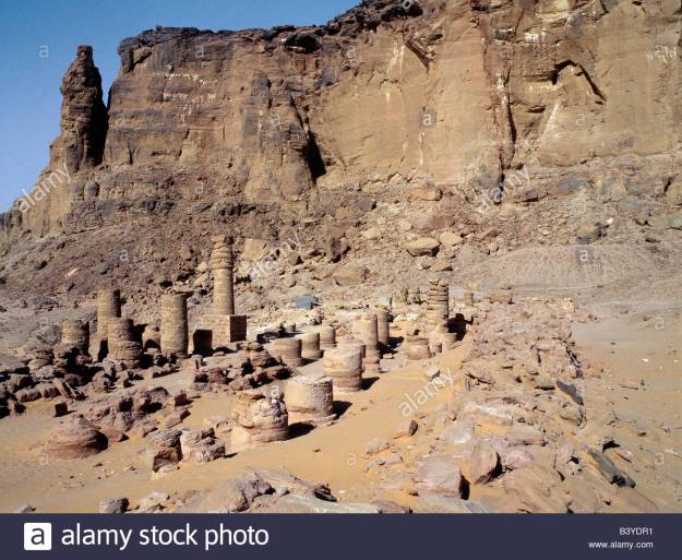
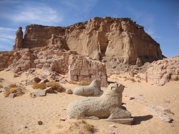
The Red Sea coast of Africa that is shown as out of the Islamic world has a size that comprises the following three major cities-harbors, namely Aydhab, Suakin and Massawa. These cities are mistakenly depicted as lying out of the Islamic control.


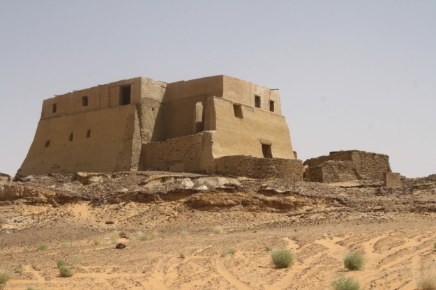
Aydhab is today a desolate place in the so-called triangle of Halaib; this means that it is located within today’s Egyptian territory and in its south-easternmost extremity, which is considered by Sudan as de jure Sudanese territory.


Suakin is today a thriving harbor in Sudan’s Red Sea coast southwestwards of Jeddah, which – on the opposite seaside – was the traditional Arabian coast harbor where all Muslims disembarked when traveling to perform Hajj in Mecca and Medina.


Massawa is the main harbor or Eritrea, located in its northern coast, around 110 km from Asmara, the Eritrean capital in the inland.


What happened to Aydhab, Suakin, and Massawa in the late 13th and during the 1st half of the 14th century, when Ibn Battuta lived, traveled, and even crossed these territories? To what state did these cities belong? This is what we will examine now.


Aydhab


Aydhab belonged to a small Christian Kingdom of the indigenous nation of the Blemmyes (today’s Beja) after the Eastern Roman control of Egypt was terminated in 642 CE with the arrival of the Islamic armies, and until this southern extremity of Egypt was recaptured by the Fatimid authorities that ruled from Cairo in the end of the 10th c. CE. The local Beja royal family managed to survive as vassal for several hundreds of years, but it did not have a substantive power beyond the administration of the local affairs. They were able only to create some problems to the Islamic authorities in Cairo from time to time.


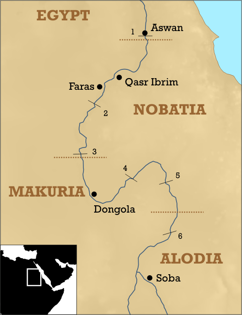
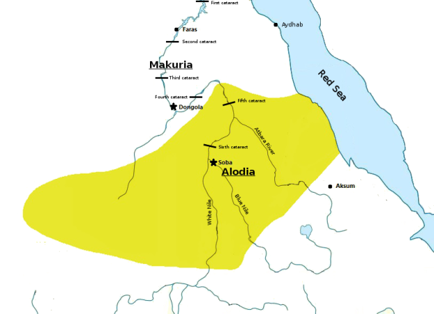
Following the Islamic occupation of Alexandria and the Northern African coast (642 – 651), the south of Egypt escaped the early Islamic Caliphate’s control and belonged to a Christian Nubian kingdom named Nobatia, which was closely linked with the Coptic Patriarchate of Alexandria. Nobatia’s capital was at Faras, not far Abu Simbel, which is today Egypt’s southernmost city on the Nile. However, some time in the 8th – 9th c., in order to face the mounting Islamic pressure from the North, Nobatia was forced to merge (despite Christological differences) with its southern neighbor Makuria, the main Christian Kushitic state in the land that was called Ethiopia by the Greeks and the Romans and Sudan by Arabic speaking people. It goes without saying that this land and this Kushitic nation have nothing to do with the Semitic, non-African, Amhara and Tigray Abyssinians who only recently usurped the name of Ethiopia which does not belong to their Semitic past, as it is diametrically opposed to their Yemenite ethnic origin. Aswan became part of the Islamic world in the early 10th c.


As the Fatimid rulers ensured full control over today’s Egypt’s territory and secured the transportation in the southernmost confines of their territory, it was very common for caravans to cross diagonally the Eastern Desert from Edfu or Aswan to Aydhab (the pattern existed in pre-Islamic times when caravans used to cross from Qena or Qift to Berenice) and then sail to Arabia, Yemen, and other destinations.


During the Crusades, Aydhab was attacked and destroyed (1182) but there was no Crusaders’ settlement in the area. King Dawud of Makuria attacked Aydhab in 1270, but this was only one of the last spasms of the Christian Ethiopian state of Makuria; the Mamluk Sultan of Egypt counterattacked and Makuria became a vassal state thus starting its downgrading spiral that led to its extinction within a century.


Aydhab was crossed by Ibn Battuta himself; this is what he wrote about it:


“Thence my way lay through a number of towns and villages to Munyat Ibn Khasib [Minia], a large town which is built on the bank of the Nile, and most emphatically excels all the other towns of Upper Egypt. I went on through Manfalut, Asyut, Ikhmim, where there is a berba with sculptures and inscriptions which no one can now read-another of these berbas there was pulled down and its stones used to build a madrasa–Qina, Qus, where the governor of Upper Egypt resides, Luxor, a pretty little town containing the tomb of the pious ascetic Abu’l-Hajjaj, Esna, and thence a day and a night’s journey through desert country to Edfu.


Camels, Hyenas, and Bejas


Here we crossed the Nile and, hiring camels, journeyed with a party of Arabs through a desert, totally devoid of settlements but quite safe for travelling. One of our halts was at Humaythira, a place infested with hyenas. All night long we kept driving them away, and indeed one got at my baggage, tore open one of the sacks, pulled out a bag of dates, and made off with it. We found the bag next morning, torn to pieces and with most of the contents eaten. After fifteen days’ travelling we reached the town of Aydhab, a large town, well supplied with milk and fish; dates and grain are imported from Upper Egypt. Its inhabitants are Bejas. These people are black-skinned; they wrap themselves in yellow blankets and tie headbands about a fingerbreadth wide round their heads. They do not give their daughters any share in their inheritance. They live on camels milk and they ride on Meharis [dromedaries].


One-third of the city belongs to the Sultan of Egypt and two-thirds to the King of the Bejas, who is called al-Hudrubi. On reaching Aydhab we found that al-Hudrubi was engaged in warfare with the Turks [i.e. the troops of the Sultan of Egypt], that he had sunk the ships and that the Turks had fled before him. It was impossible for us to attempt the sea-crossing [across the Red Sea], so we sold the provisions that we had made ready for it, and returned to Qus with the Arabs from whom we had hired the camels”.


At a later date, Ibn Battuta sailed from Jeddah to Aydhab; this is what he mentions about it:


“After the [AD 1332] pilgrimage I went to Judda [Jedda], intending to take ship to Yemen and India, but that plan fell through and I could get no one to join me. I stayed at Judda about forty days. There was a ship there going to Qusayr [Kosair], and I went on board to see what state it was in, but I was not satisfied. This was an act of providence, for the ship sailed and foundered in the open sea, and very few escaped.


Afterwards I took ship for Aydhab, but we were driven to a roadsted called Ra’s Dawa’ir [on the Egyptian coast of the Red Sea], from which we made our way [overland] with some Bejas through the desert to Aydhab. Thence we travelled to Edfu [on the Nile] and down the Nile to Cairo, where I stayed for a few days, then set out for Syria and passed for the second time through Gaza, Hebron, Jerusalem, Ramlah Acre, Tripoli, and Jabala to Ladhiqiya”.


Suakin


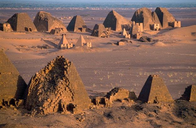
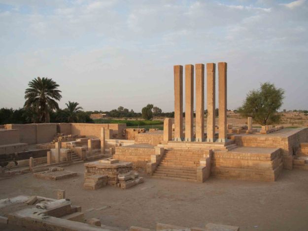
In the Antiquity, Suakin was known as Ptolemais Theron (Ptolemais of the Hunters), and it was a Ptolemaic and Roman colony that remained out of the control of the great inland state of Ethiopia (which is Sudan) that had its capital at Meroe (today’s Bagrawiyah), not far from the point where Atbarah river (Astavaras in Ancient Greek texts) joins the United Nile river.


Meroe was far greater, wealthier, and more important than Axum, the capital of Abyssinia that stretched further on the south in the mountainous area of today’s Northern Eritrea and the confines of Northern Abyssinia (today’s Fake Ethiopia). Whereas Axum, capital of Abyssinia, controlled the harbor city of Adulis (nearby today’s Massawa) and the surrounding coastland, Meroe did not control any portion the Red Sea coast of today’s Sudan. Meroe was far larger and stronger a state, but its trade with Egypt (and later the Roman Empire) and across Sahara turned it to a formidable continental power.


After the Abyssinian Axumite attack and destruction of Meroe (370 CE), and following a 50-year period of migrations and confusion, most of Meroitic Ethiopia’s territory became the center of the Christian Ethiopian state of Makuria with capital at Dunqula Agouza, around 580 km south of today’s Egyptian/Sudanese borderline. After Nobatia (further in the North) and Makuria, a third Christian state was incepted in the area of today’s Khartoum. Makuria was stronger than the other two states and controlled today’s Sudanese coastline, but in Sudan (i.e. the true Ethiopia) Christianity was spread from the North, not from the Southeast (Axumite Abyssinia). In reality, there were never good relations between the three Kushitic Christian kingdoms of Ethiopia and the Semitic kingdom of Abyssinia.


With the early expansion of Islam, the Red Sea coast escaped from the control of both, Makuria (Ethiopia) and Abyssinia, becoming part of Islamic Caliphate’s territory. As Makuria was a Sahara-centered kingdom (like Meroitic Ethiopia), the kings of Dunqulah managed to survive, prosper and expand across Sahara for many long centuries; quite contrarily, as Axumite Abyssinia was a Red Sea / Yemen-centered kingdom, it disintegrated immediately and disappeared quickly, leaving no posterior traces other ruins.


The indigenous nation of Blemmyes (Beja), who live west of the Nile in the times of the Egyptian Antiquity and whose pre-Islamic past is known for several millennia thanks to Egyptian Hieroglyphic, Greek, Latin and Coptic texts, may have enjoyed a limited independence around Suakin as a vassal state for several centuries after the early expansion of Islam. There was however no chance for a united Beja kingdom; this nation appears to have been divided across tribal lines until they were progressively Islamized.


In Islamic historiography, Suakin is first mentioned by al Hamdani. The Mamluk pressure started being felt as early as 1264, when Islamic armies from Upper Egypt took control of Suakin, although Makuria still existed in the inland. The rise of Mamluk influence in the Makurian affairs, the Islamization of part of the Makurian nobility, and the internal Beja royal rivalry between Aydhab and Suakin are the three reasons of the consolidation of Islamic control over Suakin.


After 1317, Suakin was permanently under Islamic control and, few decades later, Makuria totally collapsed in the inland, leaving Alodia as the only Christian Ethiopian (Sudanese) state which survived until as late as 1600. The loyalty of the Suakin Beja ruler to the Mamluk ruler at Cairo was expressed after 1317 with the dispatch of no less than 80 slaves, 300 camels, and 30 tusks of ivory annually! Progressively the Beja became Muslims.


Al Dimashqi, who slightly antedates Ibn Battuta, mentioned the existence of a local king. Ibn Battuta referred to Suakin where he however never set foot, specifying that the local Sultan was the son of the Sharif of Mecca, and that he had inherited this position from his maternal uncles, who were Beja, which in itself testifies to an advanced level of Beja Islamization.


Massawa


The Eritrean Red Sea coast came under the Islamic Caliphate’s control as early as the middle of the 7th c. The first Islamic naval attack against the Abyssinian harbor of Adulis took place already in 640 – even before the siege of Alexandria – under the admiral of the Red Sea fleet Alkama ibn Mujazziz. After several battles and counterattacks, Adulis was finally occupied and destroyed never to recover again. Subsequently, Axum, the Abyssinian capital, was cut off from the Red Sea trade routes and deprived from its main resources; it was therefore only normal that its end came soon afterwards because the small country did not control any part of the African hinterland, having always been a Red Sea / Yemen-centered state.


The fact that the three Christian Kingdoms of Ethiopia, notably Nobatia, Makuria and Alodia in today’s Sudanese territory, had always isolated and quarantined Axumite Abyssinia played a determinant role in the final elimination of Axum.


As Beja progressively expanded, several small local kingdoms were formed across the former Abyssinian coastland (i.e. the northern coast of today’s Eritrea), and mixed marriages with Muslims (mainly Yemenite merchants and navigators) consolidated their limited basis as vassals of the Caliph.


Massawa rose gradually to prominence in the Dahlak archipelago region (around 50 km north of the ancient Abyssinian harbor of Adulis), but was always subordinated to the Islamic Caliphate as regards governmental issues, and heavily dependent on northern Beja tribes and royal lines. This tribal royal tradition continued down to the Ottoman times, when Massawa was a Turkish stronghold in the South. Then, the ‘viceroy’ of Massawa had to report to the Ottoman governor of Suakin. All the small sultanates that were formed on northern Eritrean territory were peacefully kept as vassal dependencies of the Caliphate for many centuries until they were annexed to the Ottoman Caliphate.


Conclusion


Following the above points, we can safely claim that


– the map included in the presentation “The Travels of Ibn Battuta. A Virtual Tour with the 14th Century Traveler” featured in the portal of Berkeley University is historically wrong and greatly misplaced.


– it should have included all the African Red Sea coast into the Dar al Islam territory that is the only demarcated in this map.


– the name ‘Ethiopia’ is wrongly placed nearby the Red Sea coast and should therefore be removed to the left (further in the Sudanese inland) and there replaced by ‘Makuria’ and ‘Alodia’ with the extra definition ‘Christian kingdoms of Ethiopia’. There is enough space for this information to be properly added on the map.


– to the south of Alodia, ‘Abyssinia’ should also be noted because the small and barbaric Amhara state had already been formed in 1270 (under the fake ‘Solomonic’ dynasty with the exorbitant claims and the historical falsification as foundation of its misplaced, pseudo-Christian pretensions).


– finally, alongside the Somali coast, the precision ‘Somali Sultanates’ should be added.