Tag Archives: Suakin

A Special Military Alliance with China is Egypt’s Only Chance for Survival – III

Contents

I. Grave Threats for Egypt’s Existence and Serious Danger for China’s Expansion

II. Perspectives of the Strategic Alliance between Egypt & China

III. Two Chinese Military Bases in Egypt: One Million Chinese Military on African Soil

IV. Joint Chinese-Egyptian Military Operations in Sudan and the Perspectives of a Chinese-Egyptian-Sudanese Alliance

V. Joint Chinese-Egyptian Military Operations in Libya and the Perspectives of a Chinese-Egyptian-Libyan Alliance
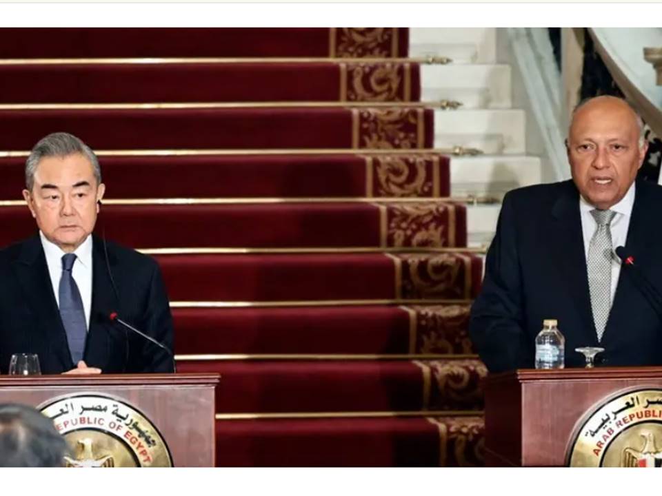
The Egyptian Foreign Minister Sameh Shoukry and the Chinese Foreign Minister Wang Yi in al-Tahrir Palace, Cairo; 14 January 2024

I. Grave Threats for Egypt’s Existence and Serious Danger for China’s Expansion

The dimensions that the War in Gaza may have for China are even more alarming than those it has for Egypt; at worldwide level, the ongoing war, which has already lasted for 3 months, takes an absolutely different appearance. Its first, pre-occupying at the international level, element was attested with the early dispatch of the US-led naval force to the Eastern Mediterranean. The reasons mentioned as the eventual ‘pretext’ were all ridiculous lies; neither Israel needed the support ‘offered’ nor did Iran have the intention to straightforwardly attack Israel. Since the beginning of the Israeli military operations in Gaza, it was definitely and accurately known that Iran and its allies (a nebula of paramilitary forces in Lebanon, Syria, Iraq and Yemen) would undertake only a low-tension war of attrition against the Zionist state. What was then the real purpose of the multinational force that reached the Eastern Mediterranean?  

Before answering this question, we have to also observe the progressive extension of the Gaza War into the wider Red Sea region. For this to happen, the thoughtless, purposeless, foolish or rather artfully induced Houthi attacks, as well as the ensuing maritime transportation security problems were hypocritically presented as the pretext. The dispatch of another US-led naval force, this time in the vast Red Sea, Gulf of Aden, and Arabian Sea regions, has -in geostrategic terms- the appearance of ‘cutting’ Asia from Africa. This consists in a direct threat to the combined interests of China, India and Russia.

What business is it of Washington to possibly care about that part of the world?

In reality, maritime transportation security is more central to Chinese interests than to American concerns. This fact underscores the concealed reality of the ridiculously called ‘Israel-Hamas War’; acting as a US puppet, the evidently and ferociously anti-Israeli, anti-Jewish, and anti-Zionist Benjamin Netanyahu first radicalized the Gazan Palestinians by promoting Hamas among them, second induced them to hit after the 9/11 example, third allowed them to calmly and without opposition carry out the 7 October 2023 attacks, and fourth declared war against the Gazans in order to subtly bring the US naval forces in.

And why does Netanyahu want the war to last long? Every day, the Netanyahu government sends coffins with the dead bodies of soldiers to their families. Does he really care? Does he believe that Israel’s embattled army will eliminate Palestinian resistance? No! These topics are insignificant to the devilish, pro-Anglo-Saxon, much wanted gangster Netanyahu. The fake state of Israel is a burned card for him; he duly and fully utilizes that structure only for the benefit of the US world dominance.

This must be the Chinese conclusion of the theatrical act named ‘Gaza War 2023’. Beijing must therefore react and prepare the total demolition of America and the disappearance of every Anglo-Saxon impact from the world; this can certainly be done without a nuclear war. The first step will be a strongly and gradually built, sizeable Chinese military presence on the Black Continent; this will start with a Special Military Alliance between China and Egypt.

In the first of this series of articles, I expanded on a) the centuries-old Western hatred of Egypt, b) the existing historical threats against the Valley of the Nile, c) the gradual process of decomposition that the criminal Western gangsters applied to Libya and the Sudan over the past 12 years, and d) the direct relationship between the otherwise worthless Renaissance Dam (also known as GERD), which has been built in the Occupied Benishangul land (currently province) of Abyssinia (Fake Ethiopia), and the Abyssinian ‘Prophecy’ against Egypt and Sudan. This is the link:

In the second of this series of articles, I completed the presentation of the Egyptian approach to the need of the Egyptian-Chinese Military Alliance and expanded on the Chinese perspective towards the topic; more specifically, I first presented the war in Gaza and the destabilization of the Red Sea Region as a very serious issue for Egypt; then, I overviewed the historical background of the rise of China as a world super-power; at last, I duly highlighted the irrevocable prerequisites of China’s worldwide predominance. As a matter of fact, I intentionally presented China’s most demanded military presence in Africa as the sixth (: last) prerequisite; this means that there are several other spheres of activities in which China must deploy an unprecedented, systematic and long-term effort first. This is the link:

President El-Sisi & Chinese Foreign Minister Qin Gang, Cairo; 15 January 2023
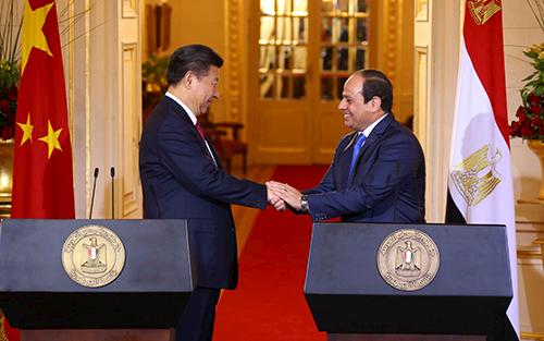
Xi Jinping in Cairo, 2016
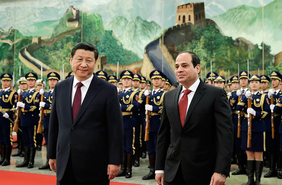
Abdelfattah el-Sisi in Beijing, 2014

II. Perspectives of the Strategic Alliance between Egypt & China

A special military alliance between Beijing and Cairo will be advantageous and fruitful for both countries only if it is considered as integral part of a strategic alliance between the two countries. The brotherhood of the two nations must be viewed from both sides as unique in their diachronic existence.

For Egypt, it must herald the irrevocable termination of all the problems that the modern state of Masr (under khedivial, royal and republican rule) has faced since 1798 and the definite cancellation of all the lasting dangers to which Cairo has been exposed. The strategic alliance with China must be the practical remake of Ancient Egypt and the comeback of its unparalleled radiation across Africa. Thanks to this groundbreaking change, Egypt will become the most influential African power in terms of Pan-African identity, Hamitic-Cushitic cultural integrity, Afrocentric educational revival, academic-scientific de-Westernization, resourceful reassessment of natural resources utilization, infrastructure and urban development, urban relocation and reconstruction, agricultural re-organization, technological and military readjustment and social overhaul.

For China, it must be the beginning of the next stage of China’s expansion and rise to world superpower status; it will function as Beijing’s Gate to Africa, because the success story of the Chinese-Egyptian strategic alliance will later serve as model for further/similar bilateral agreements and alliances, notably with Algeria, Nigeria, Mali, Ethiopia, Somalia, Tanzania, Congo, etc. A group of ca. 1000 Chinese specialists on Egypt will have to envision how to efficiently, comprehensively and promptly transform Egypt after the Chinese model. In fact, they should have to function as a second government of Egypt – not in terms of decision-making but in respect of out-of-the-box thinking, envisioning stages of Egypt’s transformation and transmutation, suggesting them to the national government in Cairo, and after the local approval, coordinating with the respective authorities in Beijing as to how to kick off the projects.

A great number of projects in every field should therefore be identified, planned, discussed with the respective Egyptian administrative, military, academic or entrepreneurial teams, and then implemented. In the way the country functions and operates, Egypt will thus gradually be transformed into a small African China.

For all the other African countries, the successful launching of the Chinese-Egyptian strategic alliance will herald

i) the definitive removal of the obsolete, colonial practices, structures and concepts;

ii) the eradication of the ensuing corruption;

iii) the elimination of potential threats of war, persecution, oppression or genocide;

iv) the termination of the Western techniques of dependence and subordination of former colonies;

v) the final withdrawal of American, English, French and other Western military bases, troops, advisers, and diplomatic personnel; and

vi) the irrevocable cancellation of

a) the colonially imposed Western pedagogical-educational-academic system;

b) all the bilateral agreements between African countries and the major colonial states in the sectors of Education, Academic Research, Scientific Cooperation, and Cultural Exchanges; 

c) the racist Western narrative, the Eurocentric bogus-historical dogma, the fallacy of the Judeo-Christian civilization, and the falsehood of Greco-Roman civilization;

d) the replacement of the Western archaeological schools and institutes with Chinese, Russian, Indian, Japanese, Iranian and Turkish specialists;

e) the end of French and English as foreign languages across Africa; and

f) the prohibition of Western missionaries to move and proselytize on African soil.
III. Two Chinese Military Bases in Egypt: One Million Chinese Military on African Soil

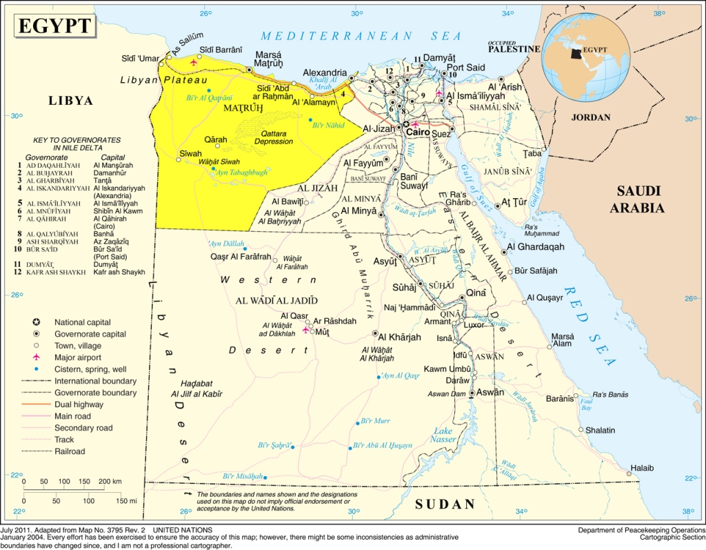
For major changes to be initiated in Egypt, Cairo should offer (in terms of a 99-year lease) two sizeable military footholds to China, one in the country’s NW confines, nearby the Mediterranean coast between Mersa Matruh and El Salloum, and another in Egypt’s SE extremities, in the Red Sea Governorate, between Ras Banas and Bi’r Shalatayn (or Shalateen), outside the Halaib Triangle. Each military base should cover an area of approximately 5000 km2.
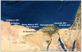
Mersa Matruh and El Salloum
The military installations should comprise several independent sectors and involve parallel activities; more specifically,

– a first sector shall be established as proper military base with an airfield and a military port, including various Chinese airborne and special operations units, division headquarters, command center, training ground, proving ground, and a great number of properly selected brigades and regiments. The scope of this sector shall be the training of the Chinese Army of Africa, the accommodation of personnel, the storage of equipment, and the facilitation of operations throughout the Black Continent.

– a second sector shall shelter specially established Chinese and Egyptian units and be utilized for the training of the Egyptian army in the Chinese method of war, army organization, martial arts, language, and warrior spirit. All the different units of the Egyptian Army, involving armored corps, the artillery corps, the airborne corps, the infantry/mechanized forces, the special forces, etc. will be rotating in the sector. The end target shall be the complete sinicization of the Egyptian armed forces. Amongst others, here will be planned (and subsequently implemented) the total and complete replacement of the equipment of the Egyptian Army with the respective Chinese material at all levels. The program will be rolled out across all the agencies and the departments of the Egyptian Ministry of Defense. All the Chinese military officers, army employees, specialists, soldiers and auxiliaries, who will be dispatched there, will have as task to fully transform the Egyptian Army after the Chinese model.  

– a third sector shall accommodates the headquarters of the local annexes of the People’s Liberation Army (PLA) National Defense University, the National University of Defense Technology (中国人民解放军国防科学技术大学), the PLA Information Engineering University, and the Army Command College of the Chinese People’s Liberation Army. Coordinating with the Egyptian Military Academy and Egypt’s Chief of Staff, and acting under the auspices of the Supreme Commander of the Armed Forces (namely the President of Egypt) and the Commander-in-Chief of the Armed Forces (i.e. the Minister of Defense), all the local annexes of the above mentioned Chinese institutions shall produce the military officers of Egypt’s entirely new army, which will gradually supersede and replace the present one.

– last, a fourth sector shall function as a military industrial zone; a great number of Chinese defense manufacturing and defense technology companies will therefore be authorized to found subsidiaries and establish local manufacturing plants. Chinese and Egyptian personnel will staff the joint ventures which will cover local and regional needs, thus not only covering all the needs of Egypt in terms of military equipment but also contributing to Egypt’s exports.

The scope of the special military alliance between China and Egypt will be groundbreaking enough to totally transform the Egyptian state’s structures of colonial dependence that has lasted more than 200 years. The two military bases will be able to accommodate about one million Chinese personnel and a corresponding number of Egyptians. The very early stages of the alliance will also comprise of several military operations outside the borders of Egypt for the benefit of both countries and the promotion of the common geopolitical goals. The need for them may be urgent for both, Egypt and China.
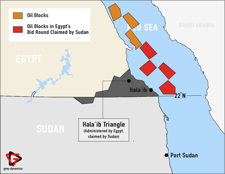
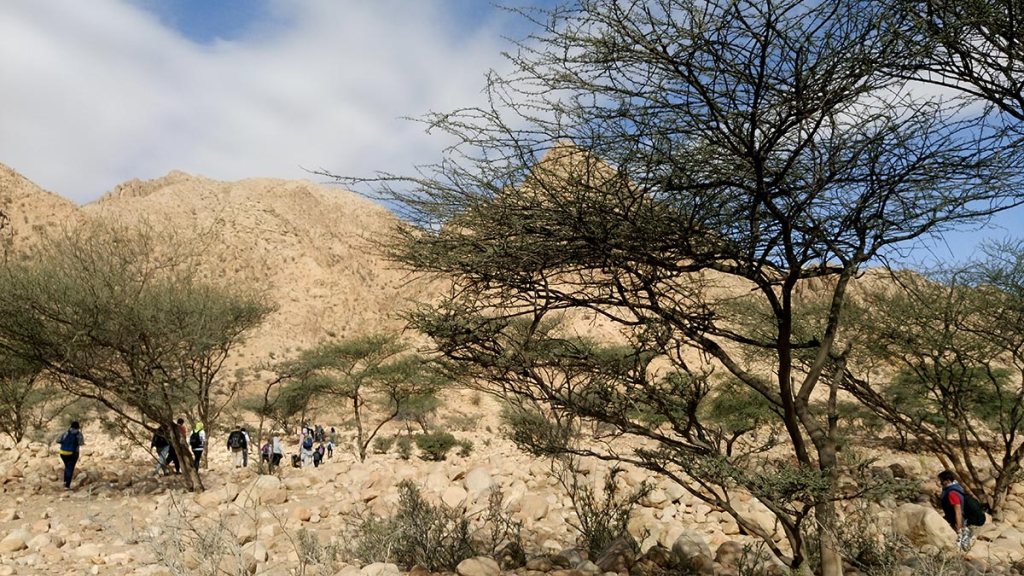
Halaib Triangle landscapes
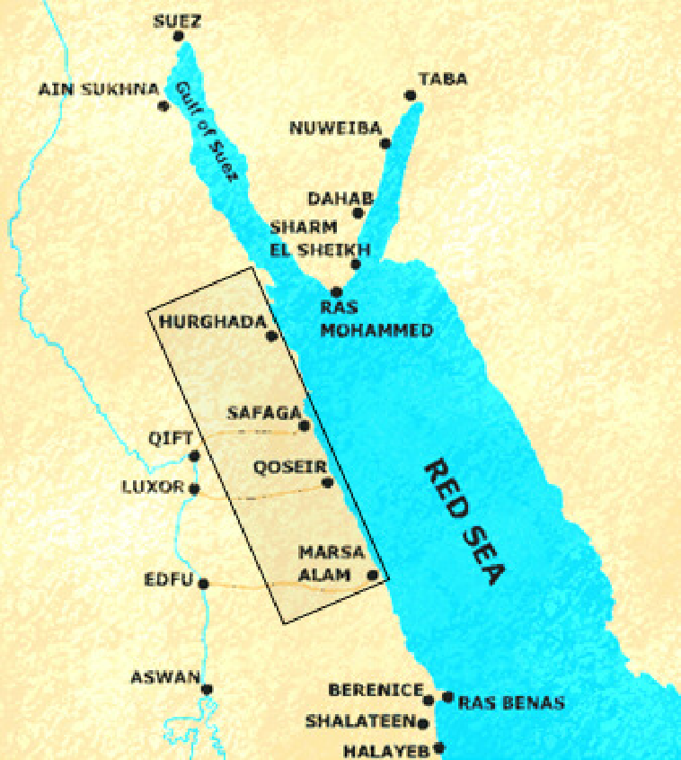
Egypt’s Red Sea coast
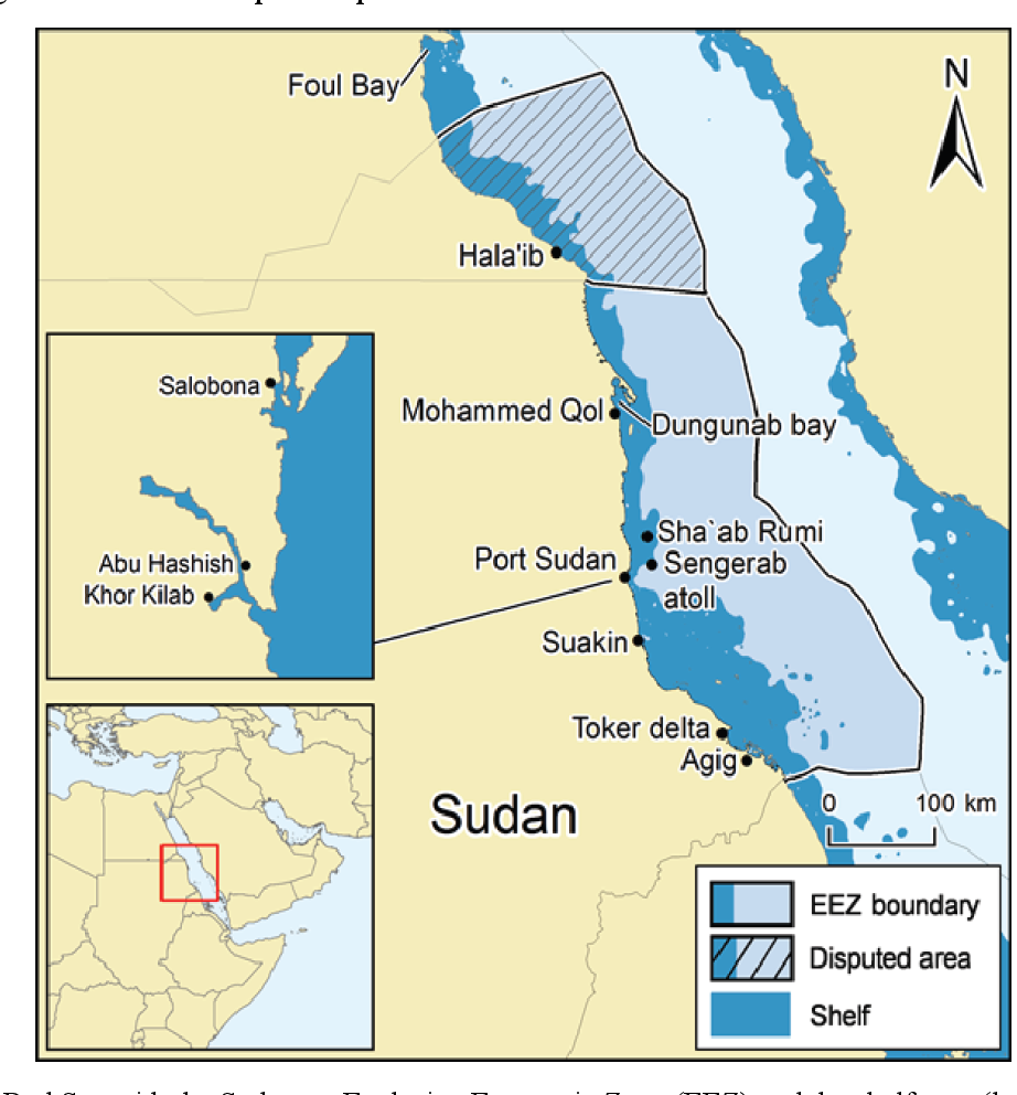
Sudan’s Red Sea coast
IV. Joint Chinese-Egyptian Military Operations in Sudan and the Perspectives of a Chinese-Egyptian-Sudanese Alliance

To prepare for a major socio-economic and political overhaul, which is most needed, Egypt has to secure its backyard; this definitely means that the chaotic conditions, which currently prevail in Sudan and Libya, must be terminated once for all. While the fall of Gadhafi in 2011 did not have significant repercussions on Egypt, the present situation in Sudan is very alarming.

Cairo managed to establish a form of cooperation with the Libyan strongman and commander of the Tobruk-based Libyan National Army (LNA) Khalifa Haftar (born in 1943), but the existence of Darfur’s butcher Mohamed Hamdan Dagalo (also known as Hemedti; born in 1974), his disastrous, treacherous and criminal acts in Sudan, his divisive stance, his contribution to the ongoing civil war, and -even worse- his connections with states that are openly inimical to Egypt, notably the colonial tyranny of Abyssinia (Fake Ethiopia), consist in a lethal threat for the Egyptian people and government. Background:

https://apnews.com/article/south-africa-sudan-ramaphosa-dagalo-f27d6d524a828b5a95ed1caa6447c7c3

https://sudantribune.com/article280972/

https://sudantribune.com/article281181/

https://en.wikipedia.org/wiki/Abdel_Fattah_al-Burhan

https://en.wikipedia.org/wiki/Hemedti

The following three links reveal the falsehood, the bias, and the anti-Egyptian hatred spread by the disreputable criminals of al Jazeera, which should be closed down one way or another:
https://www.aljazeera.com/news/2023/12/20/remove-him-sudan-army-chief-al-burhan-faces-calls-to-go-after-rsf-gains

https://www.aljazeera.com/news/2023/12/28/leader-of-sudans-rsf-visits-ethiopia-in-rare-foreign-trip-as-war-rages

https://www.aljazeera.com/opinions/2024/1/11/sudan-should-avoid-the-mistakes-that-kept-angola-in-conflict-for-27-years

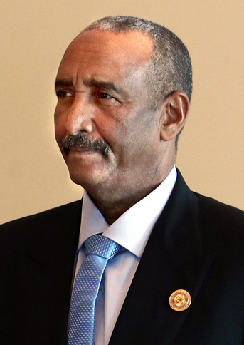
Abdel Fattah al-Burhan, 2019

Janjaweed gangster Mohamed Hamdan Dagalo (Hemedti), 2022
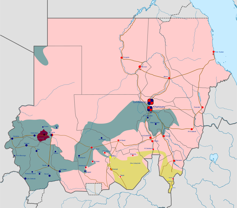
The Civil War in Sudan as of January 2024; in pink color the areas under control by the Sudanese government and Chairman Abdel Fattah al-Burhan

Egypt must support energetically and drastically Abdel Fattah al-Burhan (born in 1960), Chairman of the Transitional Sovereignty Council and de facto ruler of Sudan, who faces a rebellion actively fueled from abroad and systematically supported by the Neo-Nazi cholera of England, the notorious MI6 outfit named Qatar, and their pseudo-Muslim agents and bribed lackeys. Without a strong ally, Cairo cannot send 300000 soldiers in Sudan in order to effectively remove the Dagalo plague, terminate the killings that he causes across the unfortunate and targeted country, and avert the threat that he represents.

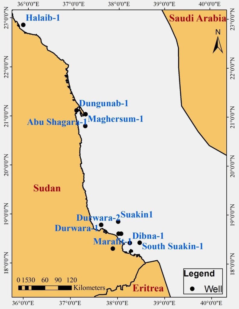
What is even worse is the condition of the transportation infrastructure in the regions around the Egyptian-Sudanese border, and in general throughout Sudan. There is no highway road running either in the Valley of the Nile (from Aswan and Abu Simbel to Wadi Halfa, Dongola, and thence to Khartoum) or alongside the Red Sea coastline (from Mersa Alam, Ras Banas, Shalatayn, Halaib, Dungunab, Port Sudan).

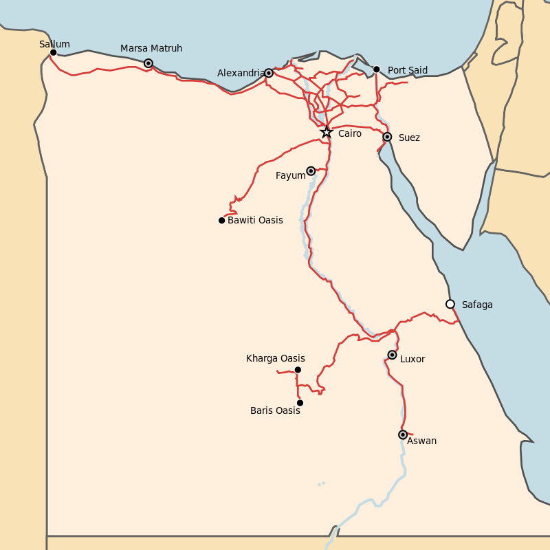
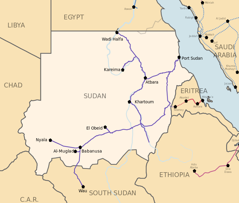
Similarly, there is no railway connection between Egypt and Sudan. This was deceitfully prescribed to their colonial subjects by the English colonials when they ruled those lands; although there was a railway connection between Cairo and Aswan (860 km; it reached Aswan only in 1898) and despite the fact that Wadi Halfa was connected with Abu Hamad, Atbara and Khartoum (350+244+313: 907 km; it was all built in the period 1897-1900, with a 475 km extension from Atbara to Port Sudan which was constructed between 1904 and 1906), there was never a railway between Aswan and Wadi Halfa, i.e. a distance of ca. 320 km. In other words, in 15 years (1890-1906), the English built in Egypt and Sudan railways that were ca. 2000 km long, but they ‘could’ not construct a small section of just 300 km! This simple observation reveals the malignant intentions of the colonial rulers quite well.
Egyptian national railways
Sudan railways

The Chinese-Egyptian military intervention in Sudan should not end with the consolidation of Abdel Fattah al-Burhan as the new president of the country and with the elimination of the Dagalo forces. After the Janjaweed bloodthirsty gangsters are extradited to the International Criminal Court for crimes against the Mankind in Darfur and generally across the country, the leadership of Sudan, Egypt and China must launch multilayered negotiations, involving governmental, entrepreneurial, military, and academic-educational authorities, in order to both, reconstruct Sudan from scratch and fully interconnect the vast country with Egypt and China.

Two highways and two railways have to link the two countries through both, the Valley of the Nile and the Red Sea coastland. In addition, two Chinese high speed railways have to be launched in order to link the first, Khartoum to Dongola, Abu Simbel, Nag Hammadi, Cairo, Alexandria, Mersa Matruh and El Salloum (in the Mediterranean coast nearby the Libyan borders), and the second, Khartoum to Atbara, Port Sudan, Shalatayn, Mersa Alam, Hurgada, Suez and Cairo. 

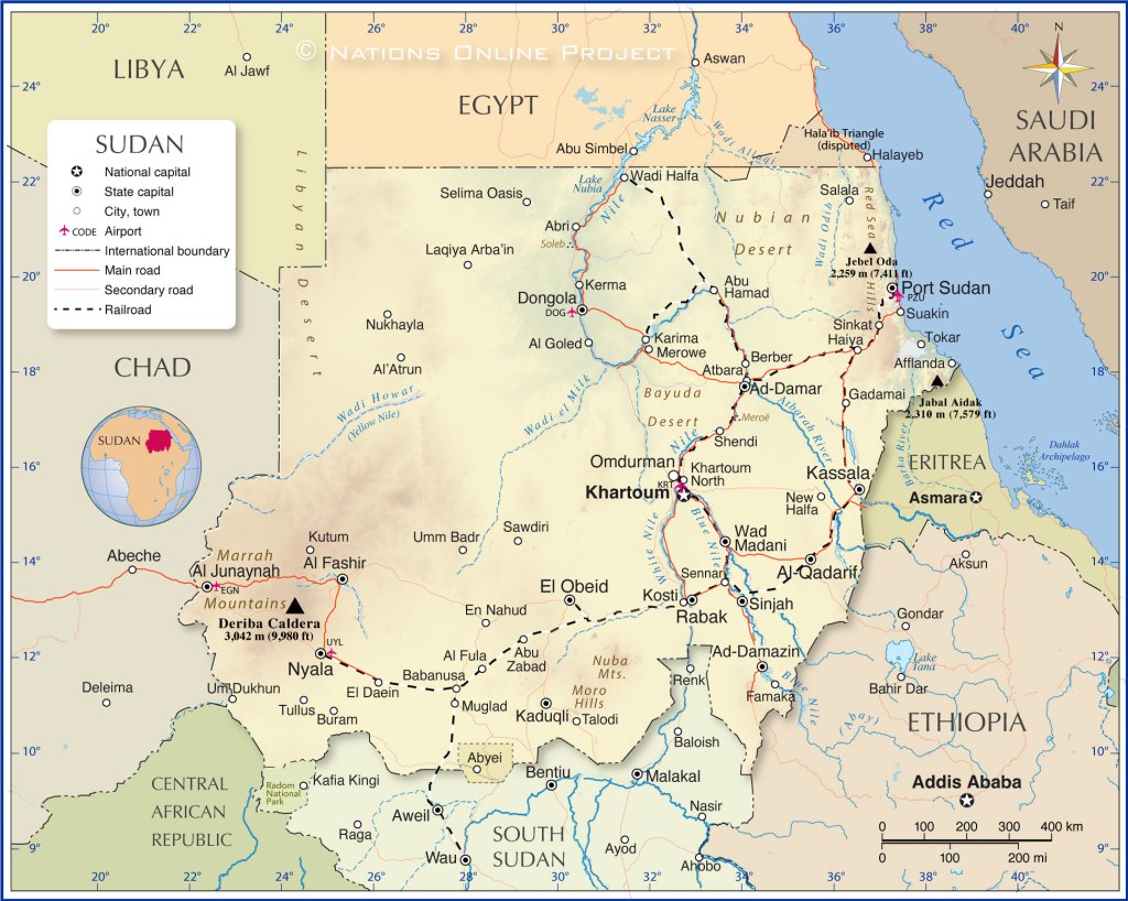
China and Sudan shall sign agreements similar to those co-signed by Beijing and Cairo (as per above Part III), and Khartoum shall offer (in terms of a 99-year lease) two sizeable military footholds to China, the first in the Red Sea coastland south of Suakin and north of Tokar, and the second in the North Darfur province (the official term is ‘state’) of Sudan, north of El Fashir, the provincial capital.   
Tokar: southernmost confines of Sudan’s Red Sea coast lands
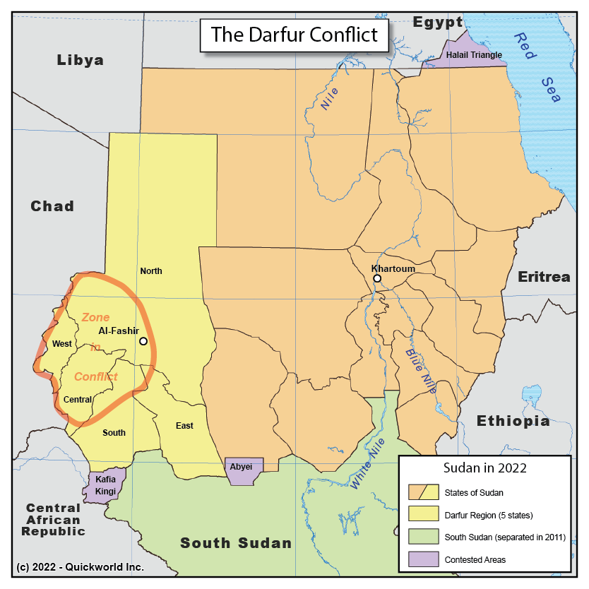
Al-Fashir, capital of Darfur North

V. Joint Chinese-Egyptian Military Operations in Libya and the Perspectives of a Chinese-Egyptian-Libyan Alliance

Having averted the prevalence of chaos in Sudan and having established a tripartite partnership in the South, Egypt will definitely have to put an end to the disastrous conditions of division, conflict and tribalism that have prevailed in Libya over the past 13 years.

Following an early agreement with Khalifa Haftar, who was appointed (2015) commander of the armed forces loyal to the Libyan House of Representatives, units of the Egyptian and the (based-in Egypt) Chinese armies shall enter Libya and fight alongside with units of the LNA to eradicate the unrepresentative, shadowy, Tripoli-based governmental structure, which has become the tool of the destructive colonial English policies in North Africa. Entering in an agreement with Brigadier General Saddam Haftar and his father, the Chinese and the Egyptians will be able to soon help consolidate Libya and bring the country closer to the Egyptian-Sudanese tandem.  
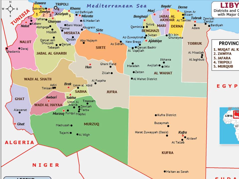
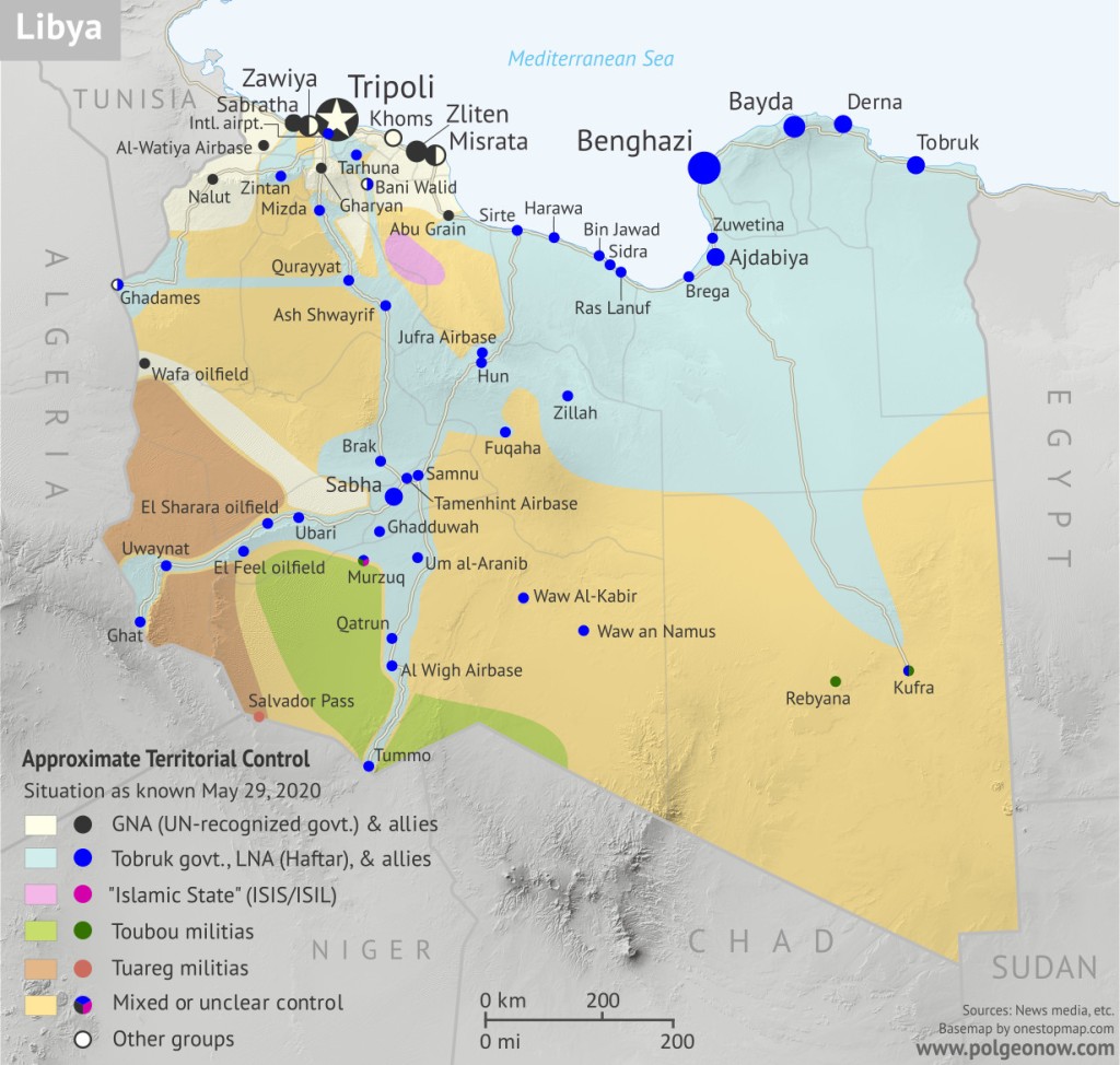
Libya, May 2020

Libya 2024

Eliminating Islamist and Wahhabi thugs from the Libyan South (notably the Kufra and Murzuq districts) and striking a deal with Tuareg militias of Ghat in Libya’s southwestern extremities, the new national government will have to manage to reestablish peace, civil order, and proper national statehood at last. With the help of China and Egypt, Libya will finally be able to move out of the colonial conditions in which the country was engulfed for too long. Background:

https://en.wikipedia.org/wiki/Kufra_District

https://en.wikipedia.org/wiki/Murzuq_District

https://en.wikipedia.org/wiki/Ghat_District

https://en.wikipedia.org/wiki/Tuareg_militias_of_Ghat

https://en.wikipedia.org/wiki/Districts_of_Libya
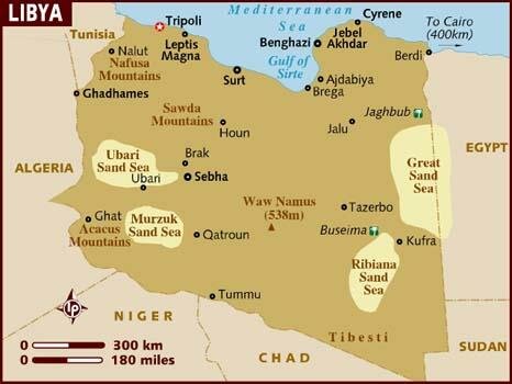
Setting the sound foundations of a long-term, non-colonial, multilateral partnership, China, Egypt and Libya shall address issues that date back to the times of colonial divisions and exploitation. Two highways and two railways have to link the Valley of the Nile with Libya, the first alongside the Mediterranean Sea coastline and the second through the desert; from Alexandria, Mersa Matruh, and El Salloum to Tobruk, Benghazi, Sirte, Misrata, Tripoli and Zuwara (near the Tunisian border), the construction of a highway and a railway will surely help exponentially increase the interconnection, interdependence and interoperability of the two countries, thus opening a new era of local, regional and worldwide cooperation. Similarly, the construction of a highway and a railway connecting Luxor, Nag Hammadi, Kharga Oasis, and Dakhla Oasis to Kufra, Murzuq, Sabha, Hun and Sirte will effectively contribute to the same goal, bringing together Egypt’s South and Libya’s South, while also lessening the distance between Libya’s southern extremities and the major cities on the coastline.   

Furthermore, China and Libya shall sign agreements similar to those co-signed by Beijing and Khartoum (as per above); according to the terms, Tripoli, as the capital of a reunified Libya, shall offer (in terms of a 99-year lease) two sizeable military footholds to China, the first in the Mediterranean coastland west of Tripoli and the second in the country’s southwestern extremities, namely in Ghat District (Fezzan region).
————————————— 

Download the article (text only) in PDF:

Download the article (text, pictures and legends) in PDF:

Islam, Makuria, Sudan, Ethiopia and Abyssinia, Map Forgery & Historical Falsification at Berkeley

By Prof. Muhammad Shamsaddin Megalommatis

map_daralislam2

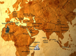
“Dar al-Islam (the Muslim World) in the 13th century” / From: “The Travels of Ibn Battuta. A Virtual Tour with the 14th Century Traveler” uploaded in the portal of Berkeley University (http://ibnbattuta.berkeley.edu/)


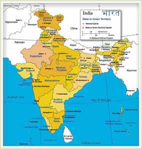
Sultanate of DelhiIndia

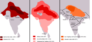
The Sultanate of Delhi during the 13th c., prior to the rise of Khilji dynasty (under the Mamluk dynasty), controlled a much smaller territory leaving not only the entire Gujarat but also large parts of Rajastan out of its control.

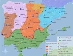
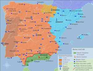
AlAndaluz1212AlAndaluz1265

13th c. Islamic territory in the Iberian Peninsula (above) & 14th c. Islamic Emirate of Granada in their real historical dimensions

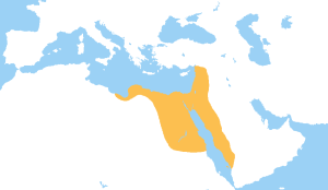
Mamluks1279

The correct borders of the Mamluk state of Egypt in the Red Sea

Involving many universities, publishing houses, mass media, encyclopedias (and notably the Wikipedia), diplomatic services, and international NGOs, a vast project of systematic map forgery of global dimensions can be attested in an almost infinite number of cases either on hard copies or online. The existing trends that can be assessed after a meticulous observation of many thousands of maps lead us to the conclusion that the undertaken forgery only reflects and strengthens the historical falsification that we can notice in the texts of articles, scholarly articles, encyclopedia entries, and books. In other words, the historical falsification that has been systematically carried out at global scale by the Freemasonic / Zionist academics and their assistants covers also an incredibly high number of maps that are available for general and specialized readership.


To analyze the character, the nature and the targets of the entire falsification process it would take volumes; however, one can briefly identify the targets as fully reflecting the essence of the historical, philosophical, religious, ideological and political falsehood that the Freemasonic / Zionist academics want to diffuse. In this case, we have to primarily deal with a vicious discrimination that takes first the unsuspicious form of a mere differentiation; some nations, peoples, countries, states, persons, concepts, and issues are favored, whereas others are disfavored.

As per the needs of the above differentiation, the historical truth is magnified, embellished, and better highlighted for those favored, whereas it is undermined, tarnished and concealed for those disfavored. The methods involved are numerous and much diversified. The size of an article is merely an example. When you publish a 3000 words entry in an encyclopedia to present the history of a less important nation, and you allot only 1500 words for the entry which is dedicated to the history of another, definitely more important nation, certainly your intentions are evil, your publications are biased, and your falsification targets are to elevate what you favor and to lower what you disfavor – particularly if the history of the more important nation happens in addition to be better documented with more historical sources, larger textual and epigraphic evidence, and a longer record of diverse archaeological findings.


Except the size of an entry, many other parameters matter as well, when it comes to a systematic falsification effort. The overall presentation, the presence or the absence of maps, pictures and diagrams, etc., everything in fact adds points to the said effort. The contents of the text, and of the maps, are certainly the most essential parts of the falsification effort, but undoubtedly not the only.


When it comes to the contents of the maps, a country can be shown bigger or smaller, the borderlines can be shifted to one or the other side, the details included can be many or few; furthermore, the background color (which defines the territoriality) can be extended beyond the level of historical reality or withdrawn to some lesser (and false) degree.


If the map contents concern a moment of the past, for the cartographic forgers the distortion needed to achieve the falsification target is certainly an easier job than in the case the map contents relate to a current situation. No one will accept in 2014 the veracity and the trustworthiness of a European political map that depicts Crimea with the same color as that of Ukraine, because it is known to all that Crimea does not belong anymore to Ukraine, having effectively seceded earlier this year.


But what happens in the case of a historical map dating back to the Islamic Ages, the Christian times or the periods of the Oriental Antiquity? In these cases, the map forgery process becomes easier. Similarly with common lies, map forgery combines elements of historical truth along with points of distortion; there cannot be a ‘full lie’, because no one will believe it. And there cannot be a total map forgery, because people will immediately identify the map as purely fictional, fake, and therefore worthless.


The extensive map forgery project reveals the existence of a detailed plan shared by many, and this takes us to the level of an advanced conspiracy. Those who deny the existence of conspiracies are contradicted and rejected by History itself, because in the last 5000 years of History we have come across thousands of cases of conspiracy undertaken by two or more people, countries or organizations against their specific targets.


Actually, if we accept for a moment the incredible falsehood that there has never been any conspiracy in the World History, we will have to interpret all the cases of map forgery and historical falsification as the result of mere human errors. This is not however possible, because there is plenty of evidence that many authors and researchers did not share the false view or idea (that takes the form of a specific map forgery or historical falsification) and that they presented a different viewpoint.


If, contrarily, these points that we consider as forgery were generally accepted as truthful and correct by all authors and researchers, and one specialist demonstrated that these points were actually wrong and mistaken, we could accept that, before the refutation and the rectification of the mistaken points, all scholars had committed an error.


We could even accept, in the case of some authors presenting the historical truth and others developing a different version, that the latter committed merely a mistake; but in this case, there should not be a specific trend (in favor of one land, country, state, nation, national history or person) that is repeated across many different maps, articles and books.


In this regard, a mere comparison helps us reveal the truth, i.e. identify whether a case of map forgery really took place. If the mistake is generally repeated by all, we can conclude that it is a real error. If the mistake occurs here and there, but there are more specialized publications that present a different, historically correct, view and do not accept the mistake, we have certainly to do with a case of deliberate forgery and not with a mistake; particularly if the specific target is the same as in many other cases of forgery, which means that the specific target was the common denominator in all these cases of forgery.


It is essential to point out at this moment that map forgery does not only occur in a specialized per subject map, but can be noticed in subject-unrelated maps and articles, which means that we are indeed in front of a vastly implemented project of forgery of disproportionate size.


One of the modern countries that has been methodically supported by the vast map forgery project and the overall historical falsification program is Abyssinia (which only recently was also fallaciously re-baptized as ‘Ethiopia’ despite the fact that, as per the Ancient Greek and Roman sources whereby this name was first used, ‘Ethiopia’ is the state, the land and the Kushitic nation immediately south of Egypt, so today’s North Sudan).


As per the needs of the historical falsification, Ethiopia is presented confusingly and mistakenly as identical with Abyssinia (whereas it is not) and also as larger of dimension. Many different maps in diverse websites and books portray Abyssinia falsely and in size greater than its real as per the historical period concerned in order to boost its image.


Example of map forgery in the portal of Berkeley University, US


In the present article, I will focus only one map and demonstrate its forged nature. It is very shameful that the map was published in the portal of an American university, but given the biased position of the US government in so many issues, taken into account the existence of various lobbies and their corrupt practices, and bearing in mind the utilization of the US universities by the US establishment and the powers that be, one can understand why this forgery was attempted at the detriment of all readers.


The forgery example is therefore taken from a presentation which, under the title “The Travels of Ibn Battuta. A Virtual Tour with the 14th Century Traveler”, is featured in the portal of Berkeley University (http://ibnbattuta.berkeley.edu/). In the section Introduction (see link) there is a map that supposedly helps the student grasp the size of the Islamic world within the limits of the then known world and the most important empires and kingdoms of the 1st half of the 14th c. Under the map, at the bottom of the page, the legend reads: “Dar al-Islam (the Muslim World) in the 13th century”. This must be a typographical error (because Ibn Battuta traveled in the 14th c.) or then the map is misplaced.


However, as the Sultanate of Delhi is depicted as having the dimensions it had under the Sultan Ala al din Khilji (1296 – 1316), I rather believe that the wrong legend is due to a typo. Actually, the Sultanate of Delhi during the 13th c., prior to the rise of Khilji dynasty (under the Mamluk dynasty), controlled a much smaller territory leaving not only the entire Gujarat but also large parts of Rajastan out of its control.


Another indication about the correct period for this map is given by the borderlines of the Islamic Emirate of Granada (Nasrid Kingdom) in Andalusia. In the map, the Nasrid state is portrayed within the borders it had during the 14th c., whereas in the 13th c. the Almohad territory was quite larger.


Last, since the map mentions the Mamluk Kingdom of Egypt, which was incepted only in 1250, so in the very middle of the 13th c., we cannot afford to take it as reflecting the historical realities of the 13th c. (it does not cover its first half) but rather the very end of the 13th c. and the 14th c. Islamic world; so this also confirms that the wrong legend is the result of a typo.


However, these are not the mistakes I wanted to discuss; nor do I want to mention the numerous general mistakes of this fabrication that is however included in the portal of Berkeley University. In fact, there are no borderlines for either the Islamic states or the other realms; this leaves the students with a very poor understanding of the era concerned.


Map forgery to portray part of 14th c. East African coast as out of Islamic control


The grave mistake, which was deliberately made in order to give a disproportionate size of, and impression about, Ethiopia, concerns the Eastern African coast. The historical truth is that the entire African coast of the Red Sea and, beyond Bab al Mandeb straits, the Eastern African coast down to today’s Mozambique was part of the Islamic world.


However, in the map, the southern borders of the Mamluk state in Egypt are wrongly placed far more in the north than their actual, historical extent. Part of the Red Sea coast of Africa that corresponds to part of the coast of Modern Egypt, the entire coast of Sudan, the northern part of Eritrea’s coast is shown as out of the Islamic World, which is totally wrong. Beyond that point, from Eritrea’s southern coastal confines to Mozambique the African coast is included within the borders of the Islamic world, which is correct.


As per the wrong borderlines of the map, the southernmost area that the Mamluk state controlled in Egypt’s Red Sea coast was Berenice and the cap Ras Banas; this is a tremendous historical mistake, because the Mamluk control extended farther in the South.


The Red Sea coast of Africa that is shown as out of the Islamic world has a size that comprises the following three major cities-harbors, namely Aydhab, Suakin and Massawa. These cities are mistakenly depicted as lying out of the Islamic control.


Aydhab is today a desolate place in the so-called triangle of Halaib; this means that it is located within today’s Egyptian territory and in its south-easternmost extremity, which is considered by Sudan as de jure Sudanese territory.


Suakin is today a thriving harbor in Sudan’s Red Sea coast southwestwards of Jeddah, which – on the opposite seaside – was the traditional Arabian coast harbor where all Muslims disembarked when traveling to perform Hajj in Mecca and Medina.


Massawa is the main harbor or Eritrea, located in its northern coast, around 110 km from Asmara, the Eritrean capital in the inland.


What happened to Aydhab, Suakin, and Massawa in the late 13th and during the 1st half of the 14th century, when Ibn Battuta lived, traveled, and even crossed these territories? To what state did these cities belong? This is what we will examine now.


Aydhab


Aydhab belonged to a small Christian Kingdom of the indigenous nation of the Blemmyes (today’s Beja) after the Eastern Roman control of Egypt was terminated in 642 CE with the arrival of the Islamic armies, and until this southern extremity of Egypt was recaptured by the Fatimid authorities that ruled from Cairo in the end of the 10th c. CE. The local Beja royal family managed to survive as vassal for several hundreds of years, but it did not have a substantive power beyond the administration of the local affairs. They were able only to create some problems to the Islamic authorities in Cairo from time to time.


Following the Islamic occupation of Alexandria and the Northern African coast (642 – 651), the south of Egypt escaped the early Islamic Caliphate’s control and belonged to a Christian Nubian kingdom named Nobatia, which was closely linked with the Coptic Patriarchate of Alexandria. Nobatia’s capital was at Faras, not far Abu Simbel, which is today Egypt’s southernmost city on the Nile. However, some time in the 8th – 9th c., in order to face the mounting Islamic pressure from the North, Nobatia was forced to merge (despite Christological differences) with its southern neighbor Makuria, the main Christian Kushitic state in the land that was called Ethiopia by the Greeks and the Romans and Sudan by Arabic speaking people. It goes without saying that this land and this Kushitic nation have nothing to do with the Semitic, non-African, Amhara and Tigray Abyssinians who only recently usurped the name of Ethiopia which does not belong to their Semitic past, as it is diametrically opposed to their Yemenite ethnic origin. Aswan became part of the Islamic world in the early 10th c.


As the Fatimid rulers ensured full control over today’s Egypt’s territory and secured the transportation in the southernmost confines of their territory, it was very common for caravans to cross diagonally the Eastern Desert from Edfu or Aswan to Aydhab (the pattern existed in pre-Islamic times when caravans used to cross from Qena or Qift to Berenice) and then sail to Arabia, Yemen, and other destinations.


During the Crusades, Aydhab was attacked and destroyed (1182) but there was no Crusaders’ settlement in the area. King Dawud of Makuria attacked Aydhab in 1270, but this was only one of the last spasms of the Christian Ethiopian state of Makuria; the Mamluk Sultan of Egypt counterattacked and Makuria became a vassal state thus starting its downgrading spiral that led to its extinction within a century.


Aydhab was crossed by Ibn Battuta himself; this is what he wrote about it:


“Thence my way lay through a number of towns and villages to Munyat Ibn Khasib [Minia], a large town which is built on the bank of the Nile, and most emphatically excels all the other towns of Upper Egypt. I went on through Manfalut, Asyut, Ikhmim, where there is a berba with sculptures and inscriptions which no one can now read-another of these berbas there was pulled down and its stones used to build a madrasa–Qina, Qus, where the governor of Upper Egypt resides, Luxor, a pretty little town containing the tomb of the pious ascetic Abu’l-Hajjaj, Esna, and thence a day and a night’s journey through desert country to Edfu.


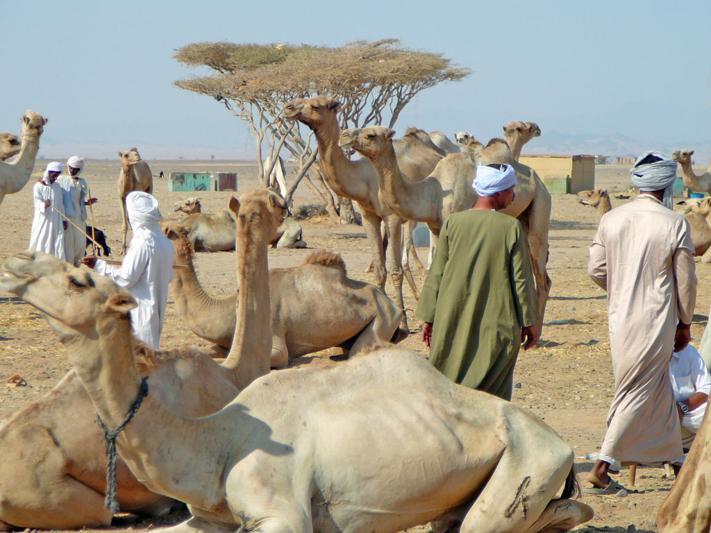
Camels, Hyenas, and Bejas


Here we crossed the Nile and, hiring camels, journeyed with a party of Arabs through a desert, totally devoid of settlements but quite safe for travelling. One of our halts was at Humaythira, a place infested with hyenas. All night long we kept driving them away, and indeed one got at my baggage, tore open one of the sacks, pulled out a bag of dates, and made off with it. We found the bag next morning, torn to pieces and with most of the contents eaten. After fifteen days’ travelling we reached the town of Aydhab, a large town, well supplied with milk and fish; dates and grain are imported from Upper Egypt. Its inhabitants are Bejas. These people are black-skinned; they wrap themselves in yellow blankets and tie headbands about a fingerbreadth wide round their heads. They do not give their daughters any share in their inheritance. They live on camels milk and they ride on Meharis [dromedaries].


One-third of the city belongs to the Sultan of Egypt and two-thirds to the King of the Bejas, who is called al-Hudrubi. On reaching Aydhab we found that al-Hudrubi was engaged in warfare with the Turks [i.e. the troops of the Sultan of Egypt], that he had sunk the ships and that the Turks had fled before him. It was impossible for us to attempt the sea-crossing [across the Red Sea], so we sold the provisions that we had made ready for it, and returned to Qus with the Arabs from whom we had hired the camels”.


At a later date, Ibn Battuta sailed from Jeddah to Aydhab; this is what he mentions about it:


“After the [AD 1332] pilgrimage I went to Judda [Jedda], intending to take ship to Yemen and India, but that plan fell through and I could get no one to join me. I stayed at Judda about forty days. There was a ship there going to Qusayr [Kosair], and I went on board to see what state it was in, but I was not satisfied. This was an act of providence, for the ship sailed and foundered in the open sea, and very few escaped.


Afterwards I took ship for Aydhab, but we were driven to a roadsted called Ra’s Dawa’ir [on the Egyptian coast of the Red Sea], from which we made our way [overland] with some Bejas through the desert to Aydhab. Thence we travelled to Edfu [on the Nile] and down the Nile to Cairo, where I stayed for a few days, then set out for Syria and passed for the second time through Gaza, Hebron, Jerusalem, Ramlah Acre, Tripoli, and Jabala to Ladhiqiya”.


Suakin


In the Antiquity, Suakin was known as Ptolemais Theron (Ptolemais of the Hunters), and it was a Ptolemaic and Roman colony that remained out of the control of the great inland state of Ethiopia (which is Sudan) that had its capital at Meroe (today’s Bagrawiyah), not far from the point where Atbarah river (Astavaras in Ancient Greek texts) joins the United Nile river.


Meroe was far greater, wealthier, and more important than Axum, the capital of Abyssinia that stretched further on the south in the mountainous area of today’s Northern Eritrea and the confines of Northern Abyssinia (today’s Fake Ethiopia). Whereas Axum, capital of Abyssinia, controlled the harbor city of Adulis (nearby today’s Massawa) and the surrounding coastland, Meroe did not control any portion the Red Sea coast of today’s Sudan. Meroe was far larger and stronger a state, but its trade with Egypt (and later the Roman Empire) and across Sahara turned it to a formidable continental power.


After the Abyssinian Axumite attack and destruction of Meroe (370 CE), and following a 50-year period of migrations and confusion, most of Meroitic Ethiopia’s territory became the center of the Christian Ethiopian state of Makuria with capital at Dunqula Agouza, around 580 km south of today’s Egyptian/Sudanese borderline. After Nobatia (further in the North) and Makuria, a third Christian state was incepted in the area of today’s Khartoum. Makuria was stronger than the other two states and controlled today’s Sudanese coastline, but in Sudan (i.e. the true Ethiopia) Christianity was spread from the North, not from the Southeast (Axumite Abyssinia). In reality, there were never good relations between the three Kushitic Christian kingdoms of Ethiopia and the Semitic kingdom of Abyssinia.


With the early expansion of Islam, the Red Sea coast escaped from the control of both, Makuria (Ethiopia) and Abyssinia, becoming part of Islamic Caliphate’s territory. As Makuria was a Sahara-centered kingdom (like Meroitic Ethiopia), the kings of Dunqulah managed to survive, prosper and expand across Sahara for many long centuries; quite contrarily, as Axumite Abyssinia was a Red Sea / Yemen-centered kingdom, it disintegrated immediately and disappeared quickly, leaving no posterior traces other ruins.


The indigenous nation of Blemmyes (Beja), who live west of the Nile in the times of the Egyptian Antiquity and whose pre-Islamic past is known for several millennia thanks to Egyptian Hieroglyphic, Greek, Latin and Coptic texts, may have enjoyed a limited independence around Suakin as a vassal state for several centuries after the early expansion of Islam. There was however no chance for a united Beja kingdom; this nation appears to have been divided across tribal lines until they were progressively Islamized.


In Islamic historiography, Suakin is first mentioned by al Hamdani. The Mamluk pressure started being felt as early as 1264, when Islamic armies from Upper Egypt took control of Suakin, although Makuria still existed in the inland. The rise of Mamluk influence in the Makurian affairs, the Islamization of part of the Makurian nobility, and the internal Beja royal rivalry between Aydhab and Suakin are the three reasons of the consolidation of Islamic control over Suakin.


After 1317, Suakin was permanently under Islamic control and, few decades later, Makuria totally collapsed in the inland, leaving Alodia as the only Christian Ethiopian (Sudanese) state which survived until as late as 1600. The loyalty of the Suakin Beja ruler to the Mamluk ruler at Cairo was expressed after 1317 with the dispatch of no less than 80 slaves, 300 camels, and 30 tusks of ivory annually! Progressively the Beja became Muslims.


Al Dimashqi, who slightly antedates Ibn Battuta, mentioned the existence of a local king. Ibn Battuta referred to Suakin where he however never set foot, specifying that the local Sultan was the son of the Sharif of Mecca, and that he had inherited this position from his maternal uncles, who were Beja, which in itself testifies to an advanced level of Beja Islamization.


Massawa


The Eritrean Red Sea coast came under the Islamic Caliphate’s control as early as the middle of the 7th c. The first Islamic naval attack against the Abyssinian harbor of Adulis took place already in 640 – even before the siege of Alexandria – under the admiral of the Red Sea fleet Alkama ibn Mujazziz. After several battles and counterattacks, Adulis was finally occupied and destroyed never to recover again. Subsequently, Axum, the Abyssinian capital, was cut off from the Red Sea trade routes and deprived from its main resources; it was therefore only normal that its end came soon afterwards because the small country did not control any part of the African hinterland, having always been a Red Sea / Yemen-centered state.


The fact that the three Christian Kingdoms of Ethiopia, notably Nobatia, Makuria and Alodia in today’s Sudanese territory, had always isolated and quarantined Axumite Abyssinia played a determinant role in the final elimination of Axum.


As Beja progressively expanded, several small local kingdoms were formed across the former Abyssinian coastland (i.e. the northern coast of today’s Eritrea), and mixed marriages with Muslims (mainly Yemenite merchants and navigators) consolidated their limited basis as vassals of the Caliph.


Massawa rose gradually to prominence in the Dahlak archipelago region (around 50 km north of the ancient Abyssinian harbor of Adulis), but was always subordinated to the Islamic Caliphate as regards governmental issues, and heavily dependent on northern Beja tribes and royal lines. This tribal royal tradition continued down to the Ottoman times, when Massawa was a Turkish stronghold in the South. Then, the ‘viceroy’ of Massawa had to report to the Ottoman governor of Suakin. All the small sultanates that were formed on northern Eritrean territory were peacefully kept as vassal dependencies of the Caliphate for many centuries until they were annexed to the Ottoman Caliphate.


Conclusion


Following the above points, we can safely claim that


– the map included in the presentation “The Travels of Ibn Battuta. A Virtual Tour with the 14th Century Traveler” featured in the portal of Berkeley University is historically wrong and greatly misplaced.


– it should have included all the African Red Sea coast into the Dar al Islam territory that is the only demarcated in this map.


– the name ‘Ethiopia’ is wrongly placed nearby the Red Sea coast and should therefore be removed to the left (further in the Sudanese inland) and there replaced by ‘Makuria’ and ‘Alodia’ with the extra definition ‘Christian kingdoms of Ethiopia’. There is enough space for this information to be properly added on the map.


– to the south of Alodia, ‘Abyssinia’ should also be noted because the small and barbaric Amhara state had already been formed in 1270 (under the fake ‘Solomonic’ dynasty with the exorbitant claims and the historical falsification as foundation of its misplaced, pseudo-Christian pretensions).


– finally, alongside the Somali coast, the precision ‘Somali Sultanates’ should be added.