
Prof. Muhammad Shamsaddin Megalommatis
Outline
Western Orientalist historiography; early sources of Iranian History; Prehistory in the Iranian plateau and Mesopotamia
6- Western Orientalist historiography
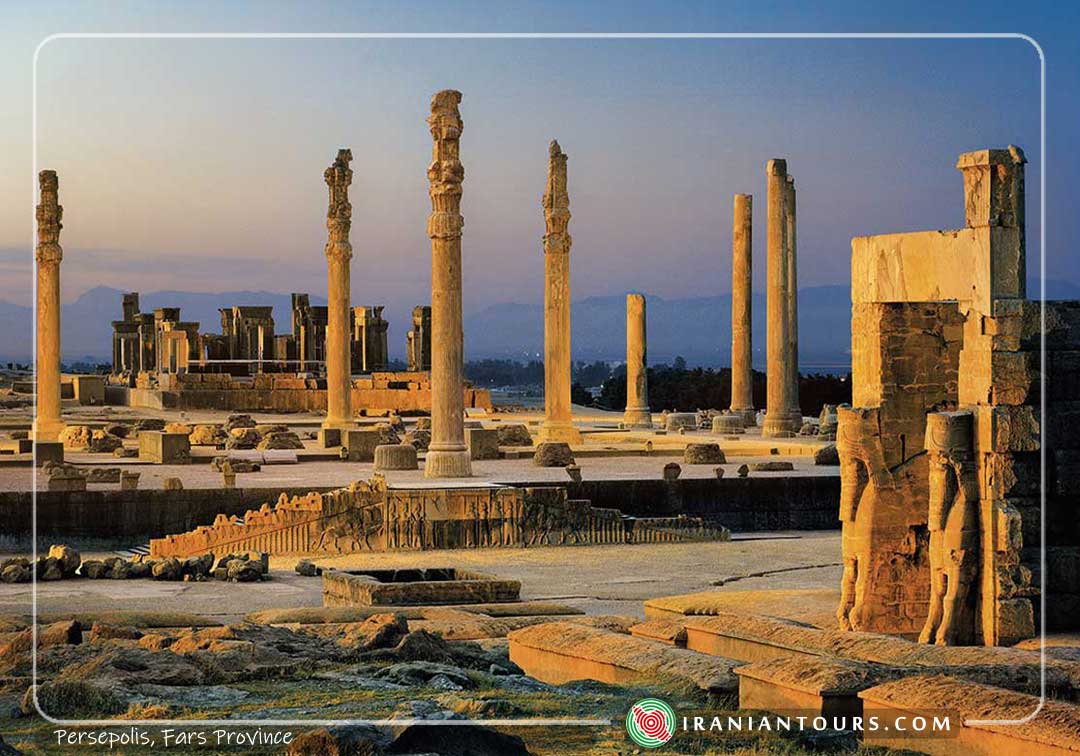
The modern Western European specialists on Iran were first based on the Ancient Hebrew, Ancient Greek and Latin sources and on travelers’ records and descriptions. On his way to China, the Italian Franciscan monk Odoric of Pordenone was the first European to probably visit (in 1320) the ruins of Parsa (Persepolis) that he called ‘Comerum’. The site was then known as Chehel Minar (چهل منار /i.e. forty minarets) and later as Takht-e Jamshid (تخت جمشید/i.e. the throne of Jamshid, a great hero of Ferdowsi’s Shahnameh and of the Iranian legendary historiography about which we discussed). The Venetian Giosafat Barbaro visited the same location in 1474 and, being the victim of the delusions about which I spoke already, he attributed the erection of the majestic monuments to the Jews!
After the rise of the Safavid dynasty and the formation of the two alliances (the French with the Ottomans and the English with the Iranians), an English merchant visited Persepolis in 1568 and wrote a description that was included in Richard Hakluyt’s ‘Voyages’ (1582). Old Achaemenid cuneiform inscriptions were first noticed and reported by the Portuguese António de Gouveia, who visited the site in 1602 and wrote about it in 1611. It is only in 1618 that the Spanish ambassador (to the court of the Safavid Shah of Iran Abbas I/1571-1629; reigned after 1588) García de Silva Figueroa associated the location with the great Achaemenid capital that was known as Persepolis in the Ancient Greek and Latin sources.
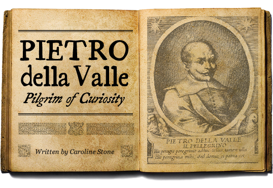
The Italian Pietro Della Valle spent five years (1616-1621) in Mesopotamia and Iran, visited Persepolis (1621), made copies of several inscriptions that he noticed there and took them back to Europe, along with clay tablets and bricks that he found in Babylon and Ur. This was the first cuneiform documentation brought to Europe. With respect to Persepolis he wrote that only 25 of the 72 original columns were still standing.
Good indication of the lunacy that Western Europeans experienced at those days due to their erroneous reading of the untrustworthy Ancient Greek historical sources about Achaemenid Iran is the following fact: after traveling in Asia and Africa, Sir Thomas Herbert wrote in his book (1638) that in Persepolis he saw several lines of strange signs curved in the walls. These were, of course, Old Achaemenid cuneiform inscriptions, but at the time, the modern term ‘cuneiform’ had not been invented; however, excessively enthused with Greek literature about Ancient Iran, he ‘concluded’ that these characters ‘resembled Greek’! He mistook cuneiform for Greek! So biased his approach was!
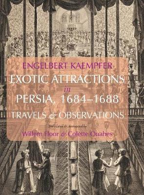
The term ‘cuneiform’ (‘Keilschrift’ in German) was coined (1700) by the German scholar and explorer Engelbert Kaempfer, who spent ten years (1683-1693) in many parts of Asia. The monumental site of the Achaemenid capital was also visited by the famous Dutch artist Cornelis de Bruijn (1704) and the famous jeweler Sir Jean Chardin, who also worked as agent of Shah Abbas II for the purchase of jewels. He was the first to publish (1711) pertinent copies of several cuneiform inscriptions.
The German surveyor Carsten Niebuhr took the research to the next stage when he copied and published (1764) the famous rock reliefs and inscriptions of Darius the Great; in fact, he brought complete and accurate copies of the inscriptions at Persepolis to Europe. He realized that he had to do with three writing systems and that the simpler (which he named ‘Class I’) comprised 42 characters, being apparently an alphabetic script. Niebuhr’s publication was used by many other scholars and explorers, notably the Germans Oluf Gerhard Tychsen, who published the most advanced research on the topic in 1798, and Friedrich Münter, who confirmed the alphabetic nature of the script (in 1802).
The reconstitution of the Iranian past proved to be far more difficult a task than that of the Ancient Egyptian heritage. This is so because, if we consider the Old Achaemenid Iranian cuneiform and the Egyptian hieroglyphics as the earliest stages of the two respective languages and scripts, Coptic (the latest stage of the Egyptian language) was always known in Europe throughout the Christian and Modern times, whereas Pahlavi and Middle Persian (the corresponding stages of the Iranian languages) were totally unknown. For this reason, Abraham Hyacinthe Anquetil-Duperron, the first French Iranologist and Indologist, played a key role in the decipherment of the cuneiform writing, although he did not spend time exploring it. But having learned Pahlavi and Farsi among the Parsis of India, he managed to study Avestan and he translated the Avesta as the sacred text of the Zoroastrians was preserved among the Parsi community. Pretty much like Coptic was essential to Champollion for the decipherment of the Egyptian hieroglyphic, the pioneering work of Anquetil-Duperron and the knowledge of Avestan, Pahlavi, Middle Persian and Farsi helped the French Antoine Isaac Silvestre de Sacy and the German Georg Friedrich Grotefend make critical breakthroughs and advance the decipherment of the Old Achaemenid.
Grotefend’s Memoir was presented to the Göttingen Academy of Sciences and Humanities in 1802, but it was rejected; in fact, he had deciphered only eight (8) letters until that moment, but most of his assumptions were correct. He had however to wait for an incredible confirmation; after Champollion completed his first step toward the decipherment of the Egyptian hieroglyphics in 1822, he read the Egyptian text of a quadrilingual inscription on the famous Caylus vase (named after a 18th c. French collector). Then, Champollion’s associate, the Orientalist Antoine-Jean Saint-Martin, announced that Grotefend’s reading of the imperial Achaemenid name ‘Xerxes’ did indeed correspond to what the Egyptian hieroglyphic text testified to. This situation generated an impetus among Orientalist scholars and explorers; until the late 1830s and the early 1840s, Grotefend, the French Eugène Burnouf, the Norwegian-German Christian Lassen, and Sir Henry Rawlinson completed the task.
Shush (Susa), an Elamite and later an Achaemenid capital, was explored in 1851, 1885-1886, 1894-1899, and then systematically excavated by the French Jacques de Morgan (1897-1911), whereas Pasargad (the early Achaemenid capital) was first explored by the German Ernst Herzfeld in 1905. Persepolis was excavated quite later, only in the 1930s by Ernst Herzfeld and Erich Schmidt of the Oriental Institute of the University of Chicago.
Not far from Hamadan (the ancient capital Hegmataneh/Ekbatana of the Medes), the splendid site of Mount Behistun (Bisotun) had become world-famous even before it was excavated (initially in 1904) by Leonard William King and Reginald Campbell Thompson (sponsored by the British Museum). This was due to the fact that the famous trilingual Behistun inscription and the associated reliefs were carved at about 100 m above ground level on a cliff, and explorers had to scale the cliff. Several fascinating descriptions of the extraordinary location were written by travelers and visitors, before academic work was carried out there. Putting his life in risk, Rawlinson copied the Old Achaemenid text in 1835, and this helped him advance considerably the decipherment of the script.
Without the decipherment of the Old Achaemenid, it would be impossible for Rawlinson to decipher the Assyrian-Babylonian cuneiform, and later for others to read the Hittite script which enabled us to have access to the most important and the most original Anatolian literature of pre-Christian times.
Behistun (Farsi: Bisotun / Old Iranian: Bagastana, i.e. ‘the place of God’) was mentioned by Ctesias, who totally misunderstood the inscription, attributing it to the ‘Babylonian’ Queen Semiramis and describing it as a dedication to Zeus! In reality, the text is part of the Annals of Emperor Darius I the Great, duly detailing his victory over a rebellion; the Iranian monarch dedicated his triumph to Ahura Mazda. Now, Semiramis seems to be an entirely misplaced Ancient Greek legend about the historical Queen of Assyria (not Babylonia!) Shammuramat. The Assyrian queen was consort of Shamshi Adad V and co-regent with her son Adad-nirari III (during his reign’s early phase). But the Assyrian Queen had nothing to do with Mount Behistun and the Achaemenid Iranian inscription.
In the early 17th c., Pietro della Valle was the first Western European to come to Behistun and sketch the remains. As a matter of fact, many European travelers and explorers visited Behistun, saw the impressive inscription, and disastrously misinterpreted it, due to their preconceived ideas, mistaken readings, and unrealistic assumptions.
A foolish English diplomat and adventurer, Robert Sherley, visited the location in 1598, and he considered the astounding reliefs and the inscriptions as ‘Christian’! Napoleon’s subordinate, General Claude-Matthieu, Comte de Gardane, visited the place in 1807 only to see in the monuments the representation of ‘Christ and his twelve apostles’! In 1817, Sir Robert Ker Porter thought that the impressive relief and inscriptions detailed the deeds of Emperor Shalmaneser V of Assyria and the transportation of the Ten Lost Tribes of Israel to the NE confines of Assyria. Last, quite interestingly, the German spiritual-scientific society Ahnenerbe, which used Hitler for their non-Nazi, highly secretive projects, explored Behistun in 1938.

7- Early sources of Iranian History: Assyrian-Babylonian Cuneiform
The early sources of Iranian History are Assyrian-Babylonian historical documents pertaining to the military, commercial and/or administrative activities of the Neo-Assyrian kings in the Zagros mountains and the Iranian plateau; these sources shed light on the earliest stages of Median, Persian and Iranian History, when the ancestors of the Achaemenids were just one of the many tribes that settled somewhere east of the borders of the Assyrian Empire.
Since the 3rd millennium BCE, Sumerian and Akkadian historical sources referred to nomads, settlers, villages, cities, strongholds and at times kingdoms situated in the area of today’s Iran. Mainly these tribes and/or realms were barbarians who either partly damaged or totally destroyed the Mesopotamian civilization and order. That’s why they were always described with markedly negative terms. On the other hand, we know through archaeological evidence that several important sites were located in the Iranian plateau, constituting either small kingdoms or outstanding entrepôts and commercial centers linking Mesopotamia with either India or Central Asia and China.
For instance, settled somewhere in the Middle Zagros, the Guti of the 3rd millennium BCE constituted a barbaric periphery that finally destroyed Agade (Akkad), the world’s first empire ever; and in the middle of the 2nd millennium BCE, the Kassites descended from Middle Zagros to Babylon, after the Old Babylonian kingdom was destroyed (in 1596) by the Hittite Mursilis I, and they set up a profane kingdom (Kassite dynasty of Babylonia) that the Assyrians never accepted as a heir of the old Sumerian-Akkadian civilization.
As both ethnic groups learned Akkadian / Assyrian-Babylonian, their rulers wrote down their names, and thus we know that neither the Guti nor the Kassites were a properly speaking Iranian nation; the present documentation is still scarce in this regard, but there are indications that some of these people bore Turanian (or Turkic) names.
For thousands of years, South Zagros and the southwestern confines of today’s Iran belonged to Elam, the main rival of Sumer, Akkad, Babylonia, and Assyria. Viewed as the true negation of the genius of Mesopotamian civilization, Elam was ruled by the ‘kings of Shushan and Anshan’; the two regions corresponded to Susa (and the entire province of Khuzestan in today’s Iran) and South Zagros respectively. The name that modern scholarship uses to denote this nation and kingdom is merely the Sumerian-Akkadian appellation of that country. In Elamite, the eastern neighbors of the Sumerians called their land ‘Haltamti’. Their language was neither Indo-European (like Old Achaemenid and Modern Farsi) nor Semitic (like Assyrian-Babylonian); it was also unrelated to Sumerian, Hurrian and Hattic, the languages of the indigenous populations in Mesopotamia and Anatolia. Recent linguistic research offers tentative approaches to the relationship between Elamite and the Dravidian languages, thus making of it the ancestral language of more than 250 million people.
Elamite linear and cuneiform writings bear witness to the life, the society, the economy, the faith and the culture of the Elamites, as well as to their relations with the Sumerians, the Akkadians, the Assyrians and the Babylonians. But they cannot help us reconstitute the History of the Iranian plateau, because the Elamites never went beyond the limits of South Zagros.
With the rise, expansion and prevalence of Assyria (from the 14th to the 7th c. BCE), we have for the first time a Mesopotamian Empire that showed great importance for the Zagros Mountains and the Iranian plateau; consequently, this means that, for the said period, we have more texts about these regions, which earlier constituted the periphery of the Mesopotamian world, but were gradually incorporated into the ever expanding Assyrian Empire. Thanks to Assyrian cuneiform texts, we know names of tribal chieftains and petty kings, cities, fortresses, ethnic groups, etc., and we can assess the various degrees of Assyrianization of each of them; but it is only at the time of Shalmaneser III (859-824 BCE) that we first find a mention of the Medes and the Persians. The former are named ‘Amadaya’ and later ‘Madaya’, whereas the latter are called ‘Parsua’ (or Parsamaš or Parsumaš).
Assyrian cuneiform texts about the Medes and the Persians more specifically are abundant during the reign of Tiglath-pileser III (745-727 BCE) and at the time of the Sargonids (722-609 BCE). It is noteworthy that the Parsua were first located in the region of today’s Sanandaj in Western Iran and later they relocated to the ancient Elamite region of Anshan (today’s Iranian province of Fars), which was devastated and emptied from its population by Assurbanipal (640 BCE). After the great Assyrian victory, which also involved the destruction of Susa, Assyrian texts mention the grandfather of Cyrus the Great, Cyrus I, as Kuraš, king of Parsumaš. He sent gifts to Nineveh and he also dispatched his eldest son (‘Arukku’ in Assyrian from a hypothetical ‘Aryauka’ in Ancient Iranian) there – nominally as a hostage, but essentially as a student of Assyrian culture, sacerdotal organization, and imperial administration and procedures.

The Black Obelisk of Shalmaneser III

Tiglathpileser III
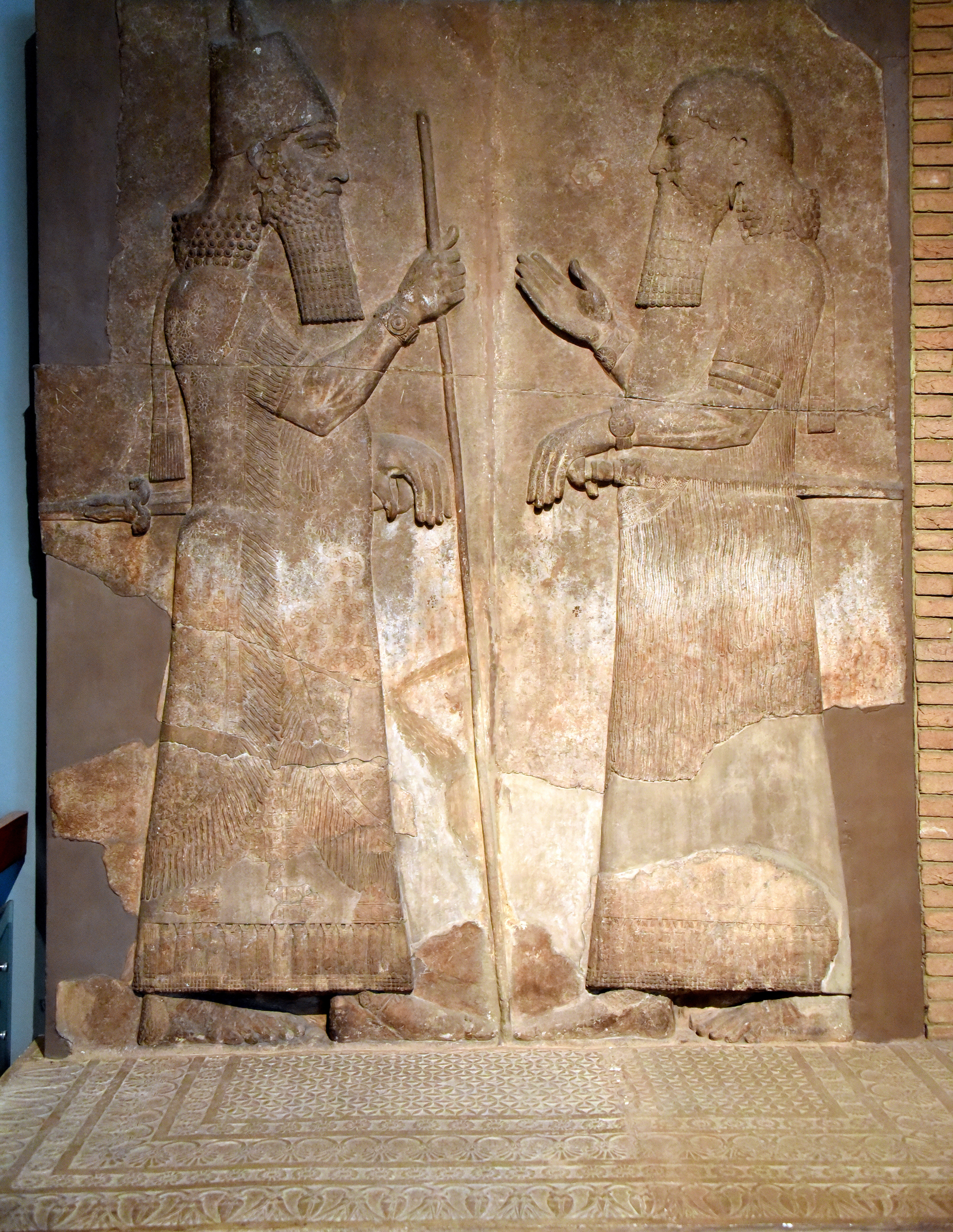
Sarrukin (Sargon of Assyria) with his son and successor Sennacherib (right)
8- Pre-History in the Iranian plateau, and Mesopotamia
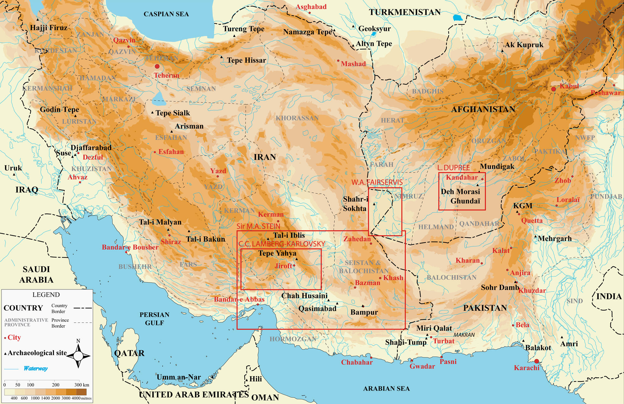
During the 4th, the 3rd and the 2nd millennium BCE, the major hitherto excavated Iranian archaeological sites are the following:
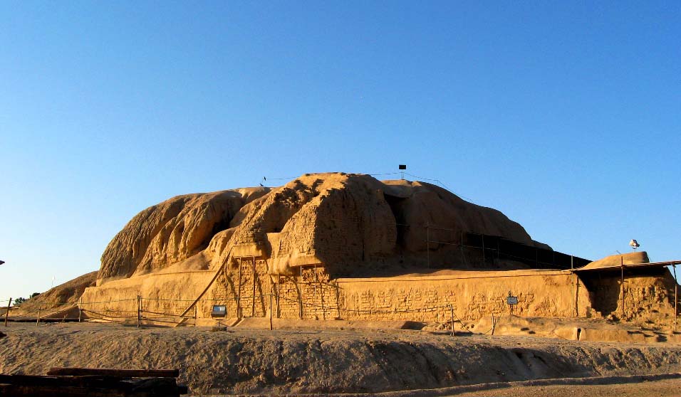
Tepe Sialk
Located near the modern city of Kashan, in the center of the Iranian plateau, and excavated in the 1930s by the Russian-French Roman Ghirshman, the site was first occupied in the period 6000-5500 BCE. The remains of the zikkurat (dating back to around 3000 BCE) show that it was the largest Mesopotamian style zikkurat. Tepe Sialk IV level (2nd half of the 4th millennium BCE) testifies to evident links with Sumer (Jemdet Nasr, Uruk) and Elam (Susa III). The site was abandoned and reoccupied in the 2nd half of the 1st millennium BCE (Tepe Sialk V and VI). Its location and the archaeological findings let us understand that the site was a key commercial center that linked Mesopotamia with Central Asia and China.
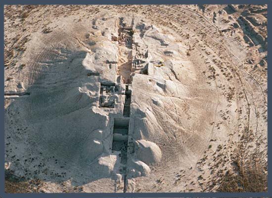
Tureng Tepe
Located close to Gorgan in Turkmen Sahra (NE Iran) and excavated by the American Frederick Roelker Wulsin in the 1930s and by the French Jean Deshayes in the 1950s, the site was inhabited in the Neolithic and then continually from 3100 to 1900 BCE, when it appears to have been the major among many other regional settlements and in evident contact with both, Mesopotamia and Central Asia. There was a disruption, and the site was occupied again only in the 7th c. BCE (Tureng Tepe IV A) by newcomers.
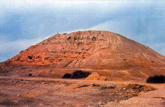
Tepe Yahya
Located at ca. 250 km north of Bandar Abbas and 220 km south of Kerman, the site was of crucial importance for the contacts between Mesopotamia and the Indus River Valley; it was also in contact with Central Asia. Excavated by the Czech-American Clifford Charles Lamberg-Karlovsky, the site was inhabited from ca. 5000 to 2200 BCE and then again after 1000 BCE. The genuine ‘Yahya Culture’ covered the first half of the 4th millennium BCE. The Proto-Elamite phase started around 3400 BCE (Tepe Yahya IV C); few proto-Elamite tablets have been unearthed from that stratum. This period corresponds to the strata Susa Cb and Tepe Sialk IV. During the 3rd millennium BCE, the site appears to have been the center of production of hard stone carving artifacts; dark stone vessels produced here were found / excavated in Mesopotamia. Similar vessels and fragments of vessels have been found in Sumerian temples in Mesopotamia, in Elam, in the Indus River Valley, and in Central Asia.
Not far from Tepe Yahya are situated several important sites that testify to the strong ties that the entire region had with Sumer and Elam in the West, the Indus River Valley in the East and Central Asia in the North; Jiroft gave the name to the ‘Jiroft culture’ which is better documented in the nearby site of Konar Sandal and covers the 3rd millennium BCE. Further in the east and close to the triangle border point (Iran, Pakistan, Afghanistan), Shahr-e Sukhteh was an enormous site which thrived between 3200 BCE and the end of the 3rd millennium BCE. It was associated with both, the ‘Jiroft culture’ and the Helmand culture, which was attested in several sites in South Afghanistan. Elamite texts were also found in that site, which already offered many surprises, involving the first known artificial eyeball and the earliest tables game with dice.
Several important prehistoric Mesopotamian sites demonstrate parallels and contacts with the aforementioned sites, notably
– Tell Halaf (near Ras al Ayn in NE Syria; the Neolithic phase lasted from 6100 to 5400 BCE, and the Bronze Age covers the 3rd and the 2nd millennium BCE),
– Tell al Ubaid (near Ur in Dhi Qar governorate; 6500-3700 BCE),
– Tell Arpachiyah (near Nineveh; the site was occupied in the Neolithic period, like Tell Halaf and Ubaid),
– Tepe Gawra (close to Nineveh; the site was occupied from 5000 to 1500 BCE),
– Tell Jemdet Nasr (near Kish in Central Iraq; 3100-2300 BCE), and
– Uruk {near Samawah in South Iraq; type site for the Uruk period (4000-3100 BCE), it was a major Sumerian kingdom and it was the world’s most populated city in the middle of the 4th millennium BCE with ca. 40000 inhabitants and another 90000 residents in the suburbs}.
In the next course, I will present a brief diagram of the History of the Mesopotamian kingdoms and Empires down to Sargon of Assyria – with focus on the relations with Zagros Mountains and the Iranian plateau.
Tepe Sialk
Tureng tepe
Tepe Yahya
————–
To watch the video (with more than 110 pictures and maps), click the links below:
HISTORY OF ACHAEMENID IRAN – Achaemenid beginnings 1Α
By Prof. Muhammad Shamsaddin Megalommatis
https://vk.com/video429864789_456239757
https://ok.ru/video/5416043547224
https://www.brighteon.com/ca749192-7c1b-4a9d-901d-5f530611c965
HISTORY OF ACHAEMENID IRAN – Achaemenid beginnings 1B
https://vk.com/megalommatis?w=wall429864789_9011%2Fall
https://ok.ru/video/5452334828120
https://www.brighteon.com/491e7afe-d4f6-4100-909c-3f35b9c57323
————————
To listen to the audio, clink the links below:
HISTORY OF ACHAEMENID IRAN – Achaemenid beginnings 1 (a+b)
https://vk.com/megalommatis?w=wall429864789_8990%2Fall
https://megalommatis.podbean.com/e/history-of-achaemenid-iran-1a-course-i-achaemenid-beginnings-1a/
——————————
Download the course in PDF:
